You are here: Home > Network List > TA - USArray Transportable Network (new EarthScope stations) Stations List
> Station I23K Minto, Yukon-Koyukuk, AK, USA > Earthquake Result Viewer
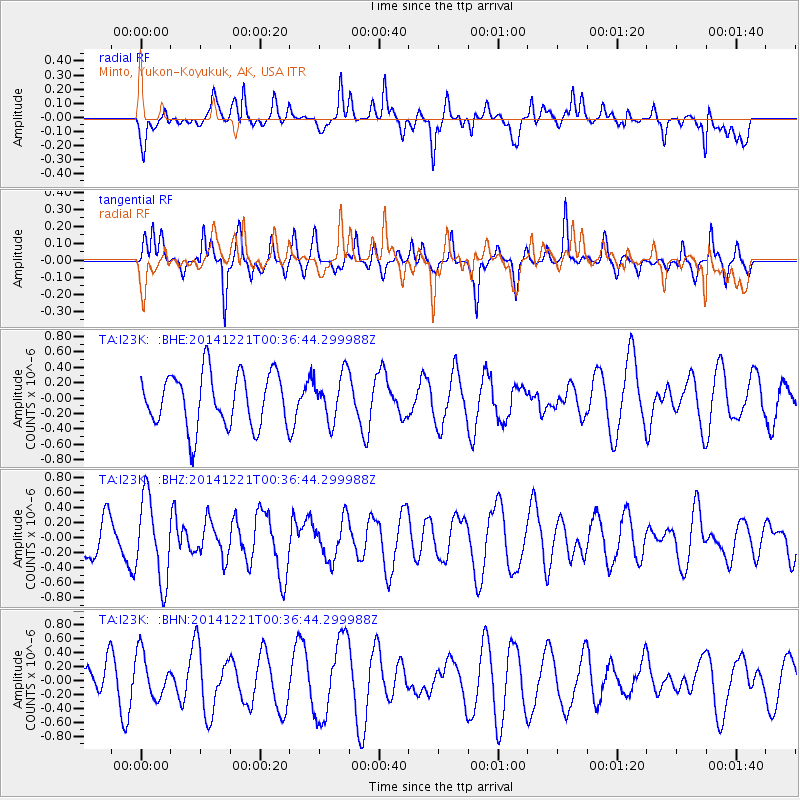
I23K Minto, Yukon-Koyukuk, AK, USA - Earthquake Result Viewer
*The percent match for this event was below the threshold and hence no stack was calculated.
| Earthquake location: |
Samar, Philippines |
| Earthquake latitude/longitude: |
11.5/125.9 |
| Earthquake time(UTC): |
2014/12/21 (355) 00:25:20 GMT |
| Earthquake Depth: |
12 km |
| Earthquake Magnitude: |
5.6 MW, 5.4 mb, 5.1 Ms_20, 5.4 Mwb, 5.6 Mwc |
| Earthquake Catalog/Contributor: |
ISC/ISC |
|
| Network: |
TA USArray Transportable Network (new EarthScope stations) |
| Station: |
I23K Minto, Yukon-Koyukuk, AK, USA |
| Lat/Lon: |
65.15 N/149.36 W |
| Elevation: |
149 m |
|
| Distance: |
77.5 deg |
| Az: |
25.536 deg |
| Baz: |
270.076 deg |
| Ray Param: |
$rayparam |
*The percent match for this event was below the threshold and hence was not used in the summary stack. |
|
| Radial Match: |
63.89952 % |
| Radial Bump: |
400 |
| Transverse Match: |
59.656498 % |
| Transverse Bump: |
298 |
| SOD ConfigId: |
3390531 |
| Insert Time: |
2019-04-15 17:12:29.154 +0000 |
| GWidth: |
2.5 |
| Max Bumps: |
400 |
| Tol: |
0.001 |
|
Signal To Noise
| Channel | StoN | STA | LTA |
| TA:I23K: :BHZ:20141221T00:36:44.299988Z | 2.6712415 | 5.526655E-7 | 2.0689461E-7 |
| TA:I23K: :BHN:20141221T00:36:44.299988Z | 1.5752121 | 3.1975847E-7 | 2.029939E-7 |
| TA:I23K: :BHE:20141221T00:36:44.299988Z | 0.870738 | 3.0481638E-7 | 3.500667E-7 |
| Arrivals |
| Ps | |
| PpPs | |
| PsPs/PpSs | |


