You are here: Home > Network List > TA - USArray Transportable Network (new EarthScope stations) Stations List
> Station I48A Sherman Twp, MI, USA > Earthquake Result Viewer
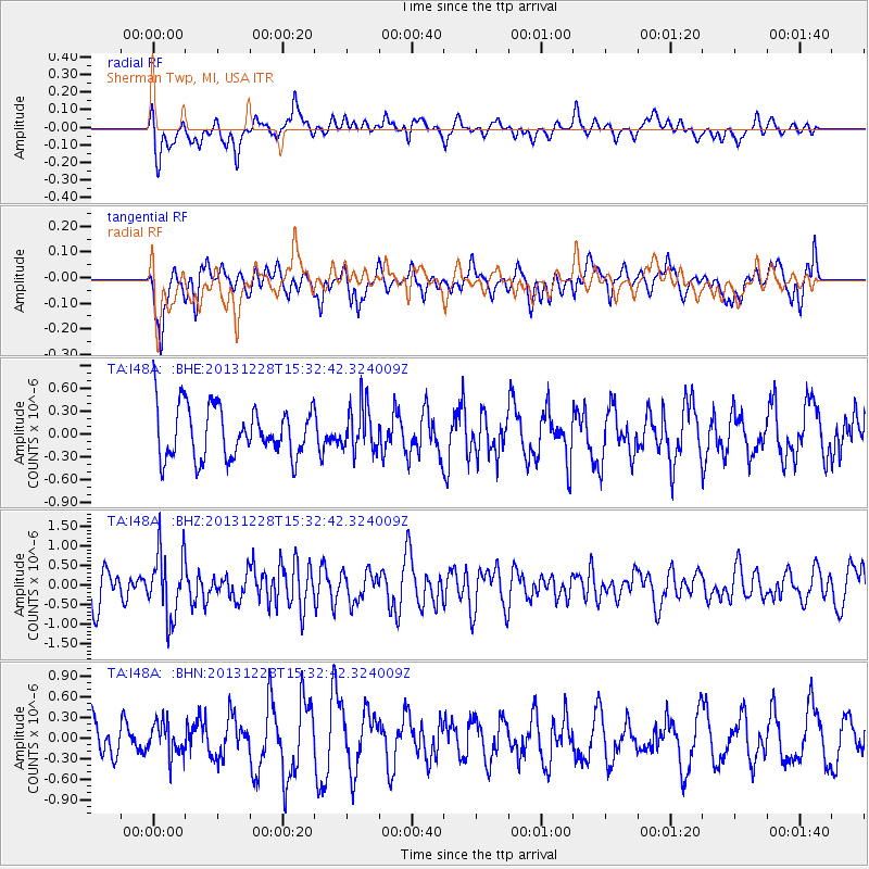
I48A Sherman Twp, MI, USA - Earthquake Result Viewer
*The percent match for this event was below the threshold and hence no stack was calculated.
| Earthquake location: |
Turkey |
| Earthquake latitude/longitude: |
36.0/31.3 |
| Earthquake time(UTC): |
2013/12/28 (362) 15:21:04 GMT |
| Earthquake Depth: |
41 km |
| Earthquake Magnitude: |
5.9 MWW, 5.9 MWB, 6.0 MWC |
| Earthquake Catalog/Contributor: |
NEIC PDE/NEIC COMCAT |
|
| Network: |
TA USArray Transportable Network (new EarthScope stations) |
| Station: |
I48A Sherman Twp, MI, USA |
| Lat/Lon: |
44.19 N/83.70 W |
| Elevation: |
192 m |
|
| Distance: |
80.8 deg |
| Az: |
318.665 deg |
| Baz: |
48.09 deg |
| Ray Param: |
$rayparam |
*The percent match for this event was below the threshold and hence was not used in the summary stack. |
|
| Radial Match: |
57.318092 % |
| Radial Bump: |
400 |
| Transverse Match: |
49.715034 % |
| Transverse Bump: |
400 |
| SOD ConfigId: |
626651 |
| Insert Time: |
2014-04-20 04:19:03.790 +0000 |
| GWidth: |
2.5 |
| Max Bumps: |
400 |
| Tol: |
0.001 |
|
Signal To Noise
| Channel | StoN | STA | LTA |
| TA:I48A: :BHZ:20131228T15:32:42.324009Z | 2.041685 | 8.447032E-7 | 4.1372846E-7 |
| TA:I48A: :BHN:20131228T15:32:42.324009Z | 0.7457857 | 2.4264358E-7 | 3.2535294E-7 |
| TA:I48A: :BHE:20131228T15:32:42.324009Z | 0.90649056 | 3.0511427E-7 | 3.3658847E-7 |
| Arrivals |
| Ps | |
| PpPs | |
| PsPs/PpSs | |


