You are here: Home > Network List > TA - USArray Transportable Network (new EarthScope stations) Stations List
> Station I59A Olmsteadville, NY, USA > Earthquake Result Viewer
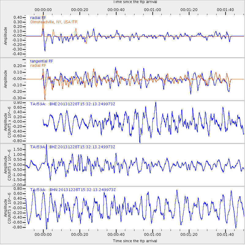
I59A Olmsteadville, NY, USA - Earthquake Result Viewer
*The percent match for this event was below the threshold and hence no stack was calculated.
| Earthquake location: |
Turkey |
| Earthquake latitude/longitude: |
36.0/31.3 |
| Earthquake time(UTC): |
2013/12/28 (362) 15:21:04 GMT |
| Earthquake Depth: |
41 km |
| Earthquake Magnitude: |
5.9 MWW, 5.9 MWB, 6.0 MWC |
| Earthquake Catalog/Contributor: |
NEIC PDE/NEIC COMCAT |
|
| Network: |
TA USArray Transportable Network (new EarthScope stations) |
| Station: |
I59A Olmsteadville, NY, USA |
| Lat/Lon: |
43.80 N/73.87 W |
| Elevation: |
390 m |
|
| Distance: |
75.5 deg |
| Az: |
313.797 deg |
| Baz: |
53.899 deg |
| Ray Param: |
$rayparam |
*The percent match for this event was below the threshold and hence was not used in the summary stack. |
|
| Radial Match: |
51.279495 % |
| Radial Bump: |
400 |
| Transverse Match: |
44.351803 % |
| Transverse Bump: |
383 |
| SOD ConfigId: |
626651 |
| Insert Time: |
2014-04-20 04:19:23.149 +0000 |
| GWidth: |
2.5 |
| Max Bumps: |
400 |
| Tol: |
0.001 |
|
Signal To Noise
| Channel | StoN | STA | LTA |
| TA:I59A: :BHZ:20131228T15:32:13.249973Z | 4.381499 | 7.409131E-7 | 1.6910036E-7 |
| TA:I59A: :BHN:20131228T15:32:13.249973Z | 1.0602387 | 4.8542495E-7 | 4.5784498E-7 |
| TA:I59A: :BHE:20131228T15:32:13.249973Z | 0.7691979 | 1.767726E-7 | 2.2981422E-7 |
| Arrivals |
| Ps | |
| PpPs | |
| PsPs/PpSs | |


