You are here: Home > Network List > TA - USArray Transportable Network (new EarthScope stations) Stations List
> Station S51A Beattyville, KY, USA > Earthquake Result Viewer
S51A Beattyville, KY, USA - Earthquake Result Viewer
*The percent match for this event was below the threshold and hence no stack was calculated.
| Earthquake location: |
Turkey |
| Earthquake latitude/longitude: |
36.0/31.3 |
| Earthquake time(UTC): |
2013/12/28 (362) 15:21:04 GMT |
| Earthquake Depth: |
41 km |
| Earthquake Magnitude: |
5.9 MWW, 5.9 MWB, 6.0 MWC |
| Earthquake Catalog/Contributor: |
NEIC PDE/NEIC COMCAT |
|
| Network: |
TA USArray Transportable Network (new EarthScope stations) |
| Station: |
S51A Beattyville, KY, USA |
| Lat/Lon: |
37.64 N/83.59 W |
| Elevation: |
286 m |
|
| Distance: |
85.1 deg |
| Az: |
313.725 deg |
| Baz: |
47.554 deg |
| Ray Param: |
$rayparam |
*The percent match for this event was below the threshold and hence was not used in the summary stack. |
|
| Radial Match: |
60.696705 % |
| Radial Bump: |
400 |
| Transverse Match: |
59.09975 % |
| Transverse Bump: |
375 |
| SOD ConfigId: |
626651 |
| Insert Time: |
2014-04-20 04:25:50.401 +0000 |
| GWidth: |
2.5 |
| Max Bumps: |
400 |
| Tol: |
0.001 |
|
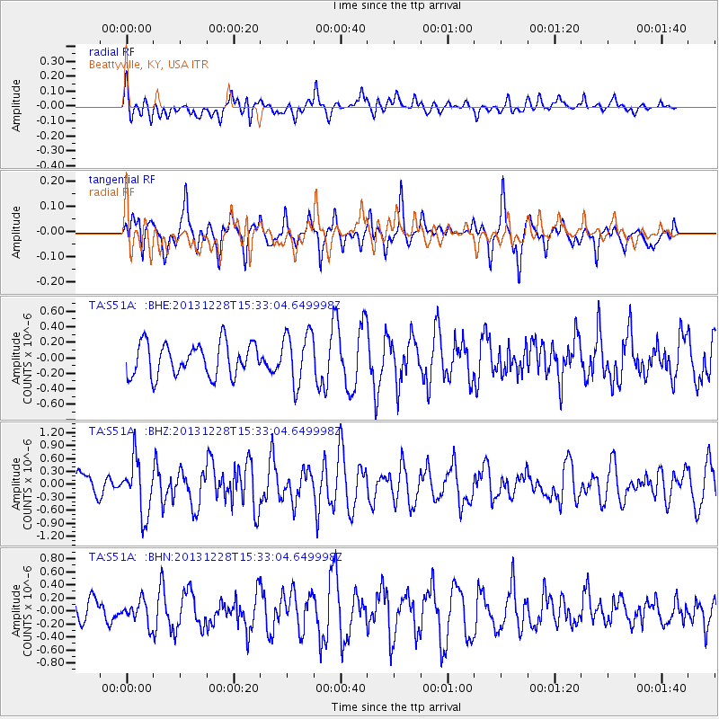
Signal To Noise
| Channel | StoN | STA | LTA |
| TA:S51A: :BHZ:20131228T15:33:04.649998Z | 1.8520161 | 6.347311E-7 | 3.427244E-7 |
| TA:S51A: :BHN:20131228T15:33:04.649998Z | 1.18683 | 1.7917164E-7 | 1.5096654E-7 |
| TA:S51A: :BHE:20131228T15:33:04.649998Z | 1.6091183 | 3.4149951E-7 | 2.1222772E-7 |
| Arrivals |
| Ps | |
| PpPs | |
| PsPs/PpSs | |


