You are here: Home > Network List > TA - USArray Transportable Network (new EarthScope stations) Stations List
> Station U59A Littleton, NC, USA > Earthquake Result Viewer
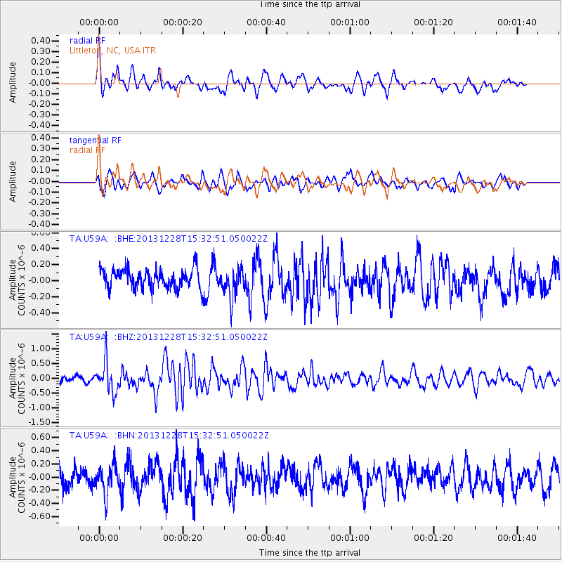
U59A Littleton, NC, USA - Earthquake Result Viewer
*The percent match for this event was below the threshold and hence no stack was calculated.
| Earthquake location: |
Turkey |
| Earthquake latitude/longitude: |
36.0/31.3 |
| Earthquake time(UTC): |
2013/12/28 (362) 15:21:04 GMT |
| Earthquake Depth: |
41 km |
| Earthquake Magnitude: |
5.9 MWW, 5.9 MWB, 6.0 MWC |
| Earthquake Catalog/Contributor: |
NEIC PDE/NEIC COMCAT |
|
| Network: |
TA USArray Transportable Network (new EarthScope stations) |
| Station: |
U59A Littleton, NC, USA |
| Lat/Lon: |
36.35 N/77.79 W |
| Elevation: |
99 m |
|
| Distance: |
82.4 deg |
| Az: |
309.691 deg |
| Baz: |
50.594 deg |
| Ray Param: |
$rayparam |
*The percent match for this event was below the threshold and hence was not used in the summary stack. |
|
| Radial Match: |
69.364136 % |
| Radial Bump: |
400 |
| Transverse Match: |
55.97404 % |
| Transverse Bump: |
400 |
| SOD ConfigId: |
626651 |
| Insert Time: |
2014-04-20 04:27:22.413 +0000 |
| GWidth: |
2.5 |
| Max Bumps: |
400 |
| Tol: |
0.001 |
|
Signal To Noise
| Channel | StoN | STA | LTA |
| TA:U59A: :BHZ:20131228T15:32:51.050022Z | 2.901072 | 5.2593344E-7 | 1.8128935E-7 |
| TA:U59A: :BHN:20131228T15:32:51.050022Z | 1.2134314 | 2.1595979E-7 | 1.7797444E-7 |
| TA:U59A: :BHE:20131228T15:32:51.050022Z | 1.5528977 | 1.8357039E-7 | 1.1821151E-7 |
| Arrivals |
| Ps | |
| PpPs | |
| PsPs/PpSs | |


