You are here: Home > Network List > CN - Canadian National Seismograph Network Stations List
> Station INK INUVIK, NT > Earthquake Result Viewer
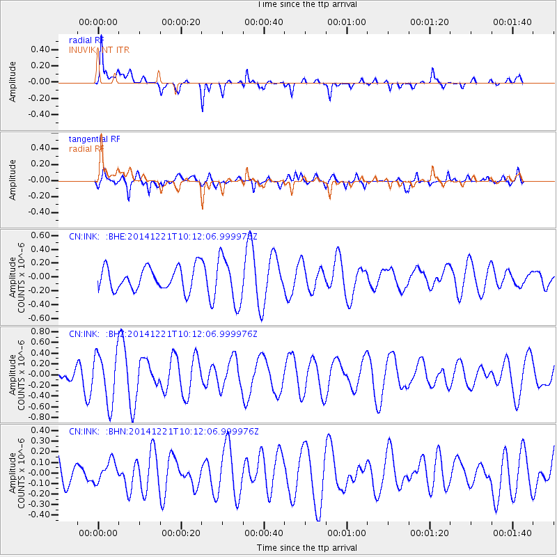
INK INUVIK, NT - Earthquake Result Viewer
*The percent match for this event was below the threshold and hence no stack was calculated.
| Earthquake location: |
Samar, Philippines |
| Earthquake latitude/longitude: |
11.5/126.0 |
| Earthquake time(UTC): |
2014/12/21 (355) 10:00:15 GMT |
| Earthquake Depth: |
37 km |
| Earthquake Magnitude: |
5.2 MW, 5.4 mb, 4.9 MS |
| Earthquake Catalog/Contributor: |
ISC/ISC |
|
| Network: |
CN Canadian National Seismograph Network |
| Station: |
INK INUVIK, NT |
| Lat/Lon: |
68.31 N/133.53 W |
| Elevation: |
44 m |
|
| Distance: |
83.3 deg |
| Az: |
21.6 deg |
| Baz: |
283.933 deg |
| Ray Param: |
$rayparam |
*The percent match for this event was below the threshold and hence was not used in the summary stack. |
|
| Radial Match: |
64.856285 % |
| Radial Bump: |
360 |
| Transverse Match: |
57.633846 % |
| Transverse Bump: |
400 |
| SOD ConfigId: |
3390531 |
| Insert Time: |
2019-04-15 17:24:05.218 +0000 |
| GWidth: |
2.5 |
| Max Bumps: |
400 |
| Tol: |
0.001 |
|
Signal To Noise
| Channel | StoN | STA | LTA |
| CN:INK: :BHZ:20141221T10:12:06.999976Z | 2.2453678 | 4.823835E-7 | 2.1483494E-7 |
| CN:INK: :BHN:20141221T10:12:06.999976Z | 0.56430435 | 1.0544356E-7 | 1.8685584E-7 |
| CN:INK: :BHE:20141221T10:12:06.999976Z | 2.085473 | 3.4316736E-7 | 1.6455134E-7 |
| Arrivals |
| Ps | |
| PpPs | |
| PsPs/PpSs | |


