You are here: Home > Network List > US - United States National Seismic Network Stations List
> Station DGMT Dagmar, Montana, USA > Earthquake Result Viewer
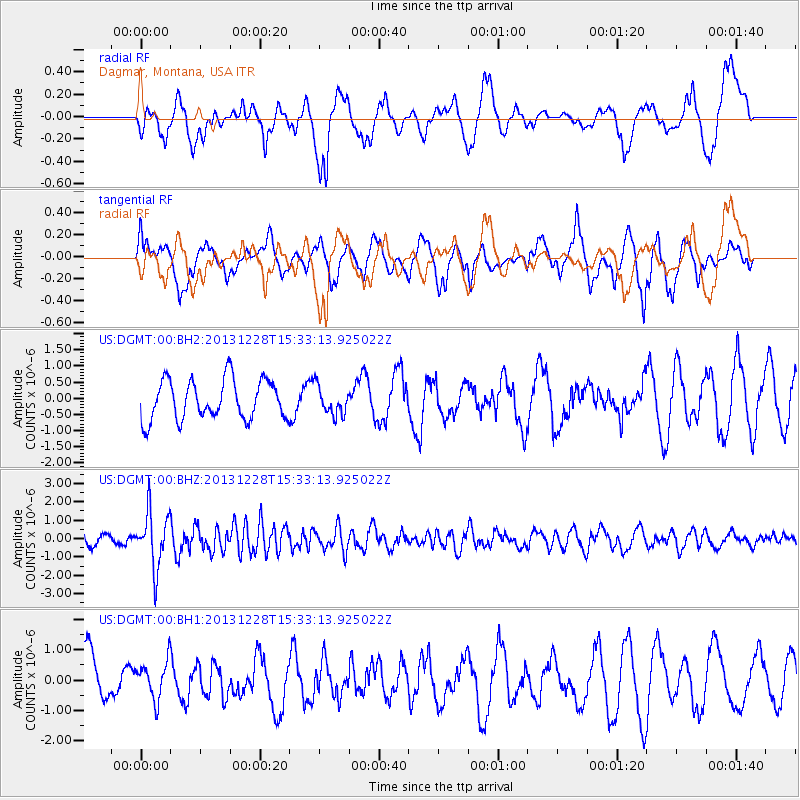
DGMT Dagmar, Montana, USA - Earthquake Result Viewer
*The percent match for this event was below the threshold and hence no stack was calculated.
| Earthquake location: |
Turkey |
| Earthquake latitude/longitude: |
36.0/31.3 |
| Earthquake time(UTC): |
2013/12/28 (362) 15:21:04 GMT |
| Earthquake Depth: |
41 km |
| Earthquake Magnitude: |
5.9 MWW, 5.9 MWB, 6.0 MWC |
| Earthquake Catalog/Contributor: |
NEIC PDE/NEIC COMCAT |
|
| Network: |
US United States National Seismic Network |
| Station: |
DGMT Dagmar, Montana, USA |
| Lat/Lon: |
48.47 N/104.20 W |
| Elevation: |
0.0 m |
|
| Distance: |
87.0 deg |
| Az: |
332.157 deg |
| Baz: |
34.672 deg |
| Ray Param: |
$rayparam |
*The percent match for this event was below the threshold and hence was not used in the summary stack. |
|
| Radial Match: |
70.6413 % |
| Radial Bump: |
400 |
| Transverse Match: |
72.07255 % |
| Transverse Bump: |
400 |
| SOD ConfigId: |
626651 |
| Insert Time: |
2014-04-20 04:30:43.378 +0000 |
| GWidth: |
2.5 |
| Max Bumps: |
400 |
| Tol: |
0.001 |
|
Signal To Noise
| Channel | StoN | STA | LTA |
| US:DGMT:00:BHZ:20131228T15:33:13.925022Z | 5.4848714 | 1.502127E-6 | 2.7386733E-7 |
| US:DGMT:00:BH1:20131228T15:33:13.925022Z | 0.74117196 | 6.3115135E-7 | 8.515586E-7 |
| US:DGMT:00:BH2:20131228T15:33:13.925022Z | 0.71721596 | 4.3734474E-7 | 6.097811E-7 |
| Arrivals |
| Ps | |
| PpPs | |
| PsPs/PpSs | |


