You are here: Home > Network List > GT - Global Telemetered Seismograph Network (USAF/USGS) Stations List
> Station LPAZ La Paz , Bolivia > Earthquake Result Viewer
LPAZ La Paz , Bolivia - Earthquake Result Viewer
*The percent match for this event was below the threshold and hence no stack was calculated.
| Earthquake location: |
North Of Ascension Island |
| Earthquake latitude/longitude: |
-1.4/-15.2 |
| Earthquake time(UTC): |
2013/12/28 (362) 18:59:04 GMT |
| Earthquake Depth: |
10 km |
| Earthquake Magnitude: |
5.8 MWW, 5.8 MWB, 6.0 MWC |
| Earthquake Catalog/Contributor: |
NEIC PDE/NEIC COMCAT |
|
| Network: |
GT Global Telemetered Seismograph Network (USAF/USGS) |
| Station: |
LPAZ La Paz , Bolivia |
| Lat/Lon: |
16.17 S/68.08 W |
| Elevation: |
4817 m |
|
| Distance: |
54.1 deg |
| Az: |
251.062 deg |
| Baz: |
79.755 deg |
| Ray Param: |
$rayparam |
*The percent match for this event was below the threshold and hence was not used in the summary stack. |
|
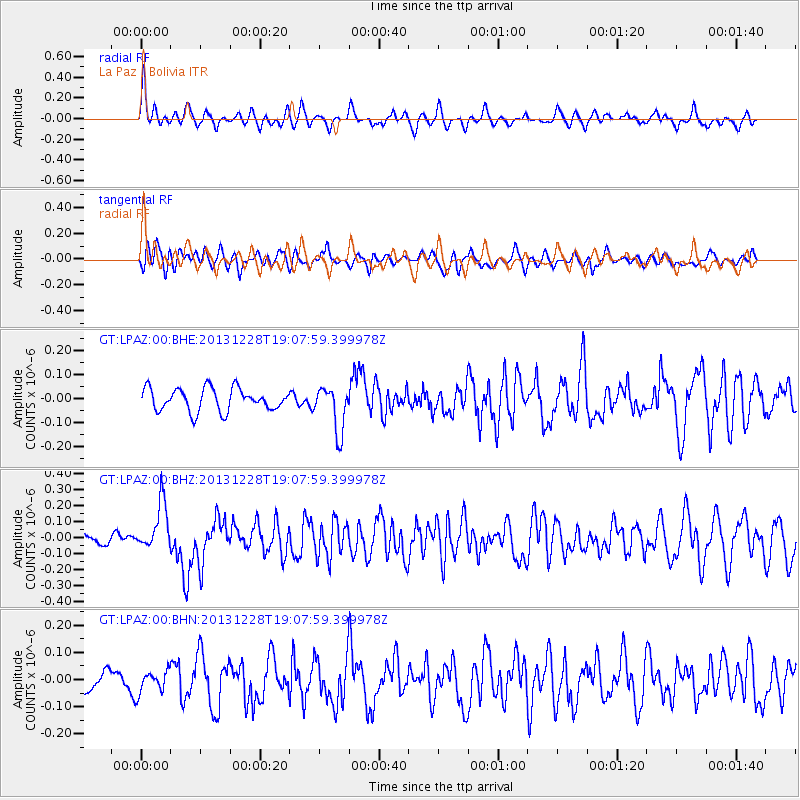
| Radial Match: |
73.04622 % |
| Radial Bump: |
400 |
| Transverse Match: |
51.07737 % |
| Transverse Bump: |
400 |
| SOD ConfigId: |
626651 |
| Insert Time: |
2014-04-20 04:37:38.765 +0000 |
| GWidth: |
2.5 |
| Max Bumps: |
400 |
| Tol: |
0.001 |
|
Signal To Noise
| Channel | StoN | STA | LTA |
| GT:LPAZ:00:BHZ:20131228T19:07:59.399978Z | 1.8752843 | 1.5095102E-7 | 8.0495006E-8 |
| GT:LPAZ:00:BHN:20131228T19:07:59.399978Z | 0.90130484 | 4.0241385E-8 | 4.4647916E-8 |
| GT:LPAZ:00:BHE:20131228T19:07:59.399978Z | 2.02003 | 9.559588E-8 | 4.7323987E-8 |
| Arrivals |
| Ps | |
| PpPs | |
| PsPs/PpSs | |


