You are here: Home > Network List > TA - USArray Transportable Network (new EarthScope stations) Stations List
> Station L50A Kingsville, ON, CAN > Earthquake Result Viewer
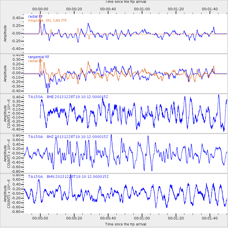
L50A Kingsville, ON, CAN - Earthquake Result Viewer
*The percent match for this event was below the threshold and hence no stack was calculated.
| Earthquake location: |
North Of Ascension Island |
| Earthquake latitude/longitude: |
-1.4/-15.2 |
| Earthquake time(UTC): |
2013/12/28 (362) 18:59:04 GMT |
| Earthquake Depth: |
10 km |
| Earthquake Magnitude: |
5.8 MWW, 5.8 MWB, 6.0 MWC |
| Earthquake Catalog/Contributor: |
NEIC PDE/NEIC COMCAT |
|
| Network: |
TA USArray Transportable Network (new EarthScope stations) |
| Station: |
L50A Kingsville, ON, CAN |
| Lat/Lon: |
42.04 N/82.81 W |
| Elevation: |
187 m |
|
| Distance: |
74.5 deg |
| Az: |
314.364 deg |
| Baz: |
106.361 deg |
| Ray Param: |
$rayparam |
*The percent match for this event was below the threshold and hence was not used in the summary stack. |
|
| Radial Match: |
57.171238 % |
| Radial Bump: |
400 |
| Transverse Match: |
56.43234 % |
| Transverse Bump: |
400 |
| SOD ConfigId: |
626651 |
| Insert Time: |
2014-04-20 04:46:04.294 +0000 |
| GWidth: |
2.5 |
| Max Bumps: |
400 |
| Tol: |
0.001 |
|
Signal To Noise
| Channel | StoN | STA | LTA |
| TA:L50A: :BHZ:20131228T19:10:12.000015Z | 0.8369391 | 1.3852083E-7 | 1.6550885E-7 |
| TA:L50A: :BHN:20131228T19:10:12.000015Z | 1.2317984 | 3.1650777E-7 | 2.569477E-7 |
| TA:L50A: :BHE:20131228T19:10:12.000015Z | 1.0755032 | 1.4783392E-7 | 1.3745557E-7 |
| Arrivals |
| Ps | |
| PpPs | |
| PsPs/PpSs | |


