You are here: Home > Network List > TA - USArray Transportable Network (new EarthScope stations) Stations List
> Station R49A Shelbyville, KY, USA > Earthquake Result Viewer
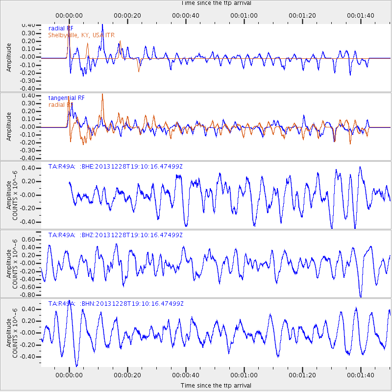
R49A Shelbyville, KY, USA - Earthquake Result Viewer
*The percent match for this event was below the threshold and hence no stack was calculated.
| Earthquake location: |
North Of Ascension Island |
| Earthquake latitude/longitude: |
-1.4/-15.2 |
| Earthquake time(UTC): |
2013/12/28 (362) 18:59:04 GMT |
| Earthquake Depth: |
10 km |
| Earthquake Magnitude: |
5.8 MWW, 5.8 MWB, 6.0 MWC |
| Earthquake Catalog/Contributor: |
NEIC PDE/NEIC COMCAT |
|
| Network: |
TA USArray Transportable Network (new EarthScope stations) |
| Station: |
R49A Shelbyville, KY, USA |
| Lat/Lon: |
38.29 N/85.17 W |
| Elevation: |
251 m |
|
| Distance: |
75.3 deg |
| Az: |
310.129 deg |
| Baz: |
103.737 deg |
| Ray Param: |
$rayparam |
*The percent match for this event was below the threshold and hence was not used in the summary stack. |
|
| Radial Match: |
59.09061 % |
| Radial Bump: |
400 |
| Transverse Match: |
64.476845 % |
| Transverse Bump: |
400 |
| SOD ConfigId: |
626651 |
| Insert Time: |
2014-04-20 04:47:32.766 +0000 |
| GWidth: |
2.5 |
| Max Bumps: |
400 |
| Tol: |
0.001 |
|
Signal To Noise
| Channel | StoN | STA | LTA |
| TA:R49A: :BHZ:20131228T19:10:16.47499Z | 0.97075456 | 1.9722555E-7 | 2.0316725E-7 |
| TA:R49A: :BHN:20131228T19:10:16.47499Z | 3.1708827 | 3.8216652E-7 | 1.205237E-7 |
| TA:R49A: :BHE:20131228T19:10:16.47499Z | 1.6243955 | 1.5529685E-7 | 9.560286E-8 |
| Arrivals |
| Ps | |
| PpPs | |
| PsPs/PpSs | |


