You are here: Home > Network List > TA - USArray Transportable Network (new EarthScope stations) Stations List
> Station W41B Gary Mavity, Velonia, AR, USA > Earthquake Result Viewer
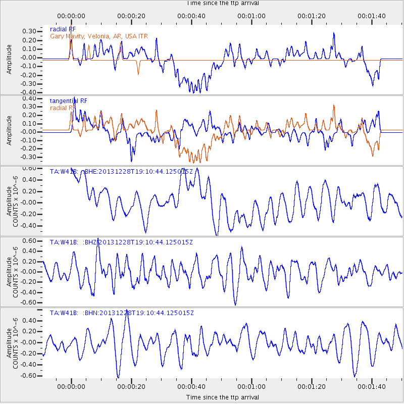
W41B Gary Mavity, Velonia, AR, USA - Earthquake Result Viewer
*The percent match for this event was below the threshold and hence no stack was calculated.
| Earthquake location: |
North Of Ascension Island |
| Earthquake latitude/longitude: |
-1.4/-15.2 |
| Earthquake time(UTC): |
2013/12/28 (362) 18:59:04 GMT |
| Earthquake Depth: |
10 km |
| Earthquake Magnitude: |
5.8 MWW, 5.8 MWB, 6.0 MWC |
| Earthquake Catalog/Contributor: |
NEIC PDE/NEIC COMCAT |
|
| Network: |
TA USArray Transportable Network (new EarthScope stations) |
| Station: |
W41B Gary Mavity, Velonia, AR, USA |
| Lat/Lon: |
35.17 N/92.25 W |
| Elevation: |
95 m |
|
| Distance: |
80.2 deg |
| Az: |
305.884 deg |
| Baz: |
98.616 deg |
| Ray Param: |
$rayparam |
*The percent match for this event was below the threshold and hence was not used in the summary stack. |
|
| Radial Match: |
31.557663 % |
| Radial Bump: |
400 |
| Transverse Match: |
39.578407 % |
| Transverse Bump: |
400 |
| SOD ConfigId: |
626651 |
| Insert Time: |
2014-04-20 04:48:54.122 +0000 |
| GWidth: |
2.5 |
| Max Bumps: |
400 |
| Tol: |
0.001 |
|
Signal To Noise
| Channel | StoN | STA | LTA |
| TA:W41B: :BHZ:20131228T19:10:44.125015Z | 1.0693798 | 2.1929246E-7 | 2.0506509E-7 |
| TA:W41B: :BHN:20131228T19:10:44.125015Z | 1.0683862 | 2.2045548E-7 | 2.0634437E-7 |
| TA:W41B: :BHE:20131228T19:10:44.125015Z | 0.4397723 | 1.1451956E-7 | 2.6040647E-7 |
| Arrivals |
| Ps | |
| PpPs | |
| PsPs/PpSs | |


