You are here: Home > Network List > TA - USArray Transportable Network (new EarthScope stations) Stations List
> Station G03D McMinnville, OR, USA > Earthquake Result Viewer
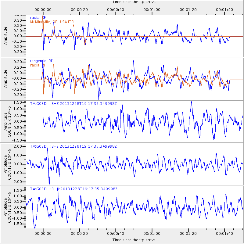
G03D McMinnville, OR, USA - Earthquake Result Viewer
*The percent match for this event was below the threshold and hence no stack was calculated.
| Earthquake location: |
Tonga Islands |
| Earthquake latitude/longitude: |
-18.2/-174.3 |
| Earthquake time(UTC): |
2013/12/28 (362) 19:06:16 GMT |
| Earthquake Depth: |
96 km |
| Earthquake Magnitude: |
5.9 MWW, 5.9 MWB, 5.9 MWC |
| Earthquake Catalog/Contributor: |
NEIC PDE/NEIC COMCAT |
|
| Network: |
TA USArray Transportable Network (new EarthScope stations) |
| Station: |
G03D McMinnville, OR, USA |
| Lat/Lon: |
45.21 N/123.26 W |
| Elevation: |
222 m |
|
| Distance: |
78.3 deg |
| Az: |
34.155 deg |
| Baz: |
229.026 deg |
| Ray Param: |
$rayparam |
*The percent match for this event was below the threshold and hence was not used in the summary stack. |
|
| Radial Match: |
46.180397 % |
| Radial Bump: |
400 |
| Transverse Match: |
53.485344 % |
| Transverse Bump: |
400 |
| SOD ConfigId: |
626651 |
| Insert Time: |
2014-04-20 05:05:44.742 +0000 |
| GWidth: |
2.5 |
| Max Bumps: |
400 |
| Tol: |
0.001 |
|
Signal To Noise
| Channel | StoN | STA | LTA |
| TA:G03D: :BHZ:20131228T19:17:35.349998Z | 2.2985814 | 9.2944737E-7 | 4.0435694E-7 |
| TA:G03D: :BHN:20131228T19:17:35.349998Z | 0.9889235 | 5.6320425E-7 | 5.6951245E-7 |
| TA:G03D: :BHE:20131228T19:17:35.349998Z | 0.6108405 | 2.5968274E-7 | 4.2512363E-7 |
| Arrivals |
| Ps | |
| PpPs | |
| PsPs/PpSs | |


