You are here: Home > Network List > TA - USArray Transportable Network (new EarthScope stations) Stations List
> Station J05D Fort Rock, OR, USA > Earthquake Result Viewer
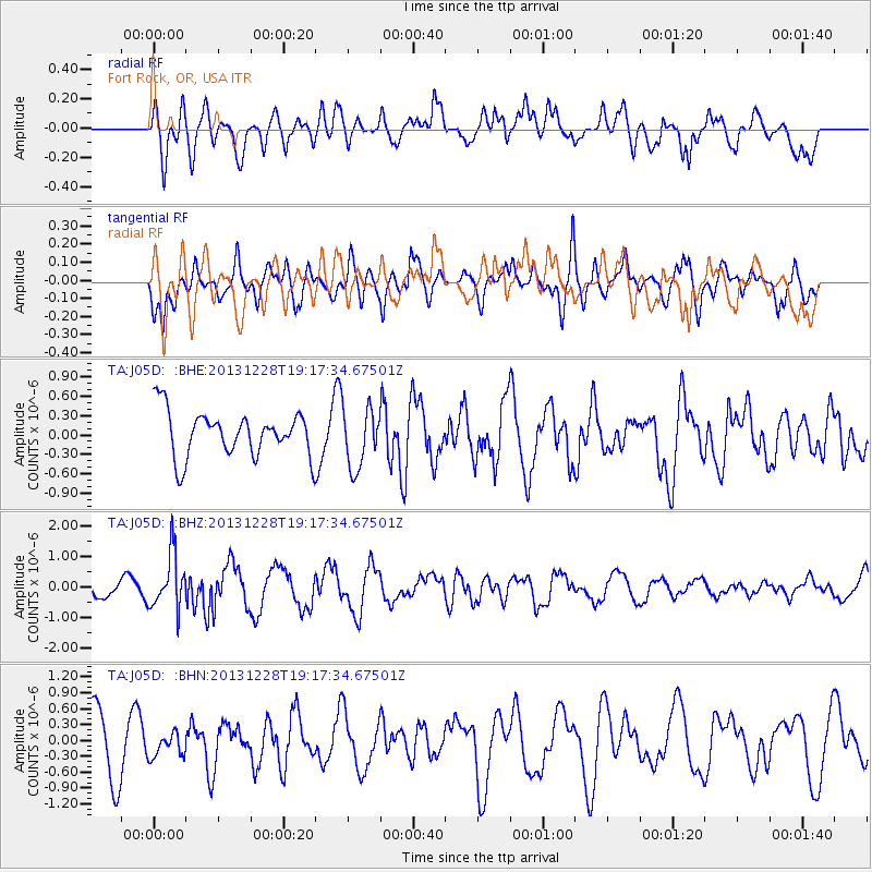
J05D Fort Rock, OR, USA - Earthquake Result Viewer
*The percent match for this event was below the threshold and hence no stack was calculated.
| Earthquake location: |
Tonga Islands |
| Earthquake latitude/longitude: |
-18.2/-174.3 |
| Earthquake time(UTC): |
2013/12/28 (362) 19:06:16 GMT |
| Earthquake Depth: |
96 km |
| Earthquake Magnitude: |
5.9 MWW, 5.9 MWB, 5.9 MWC |
| Earthquake Catalog/Contributor: |
NEIC PDE/NEIC COMCAT |
|
| Network: |
TA USArray Transportable Network (new EarthScope stations) |
| Station: |
J05D Fort Rock, OR, USA |
| Lat/Lon: |
43.28 N/121.23 W |
| Elevation: |
1541 m |
|
| Distance: |
78.2 deg |
| Az: |
36.62 deg |
| Baz: |
230.94 deg |
| Ray Param: |
$rayparam |
*The percent match for this event was below the threshold and hence was not used in the summary stack. |
|
| Radial Match: |
69.21626 % |
| Radial Bump: |
400 |
| Transverse Match: |
65.39479 % |
| Transverse Bump: |
400 |
| SOD ConfigId: |
626651 |
| Insert Time: |
2014-04-20 05:06:05.494 +0000 |
| GWidth: |
2.5 |
| Max Bumps: |
400 |
| Tol: |
0.001 |
|
Signal To Noise
| Channel | StoN | STA | LTA |
| TA:J05D: :BHZ:20131228T19:17:34.67501Z | 4.1248374 | 8.9164007E-7 | 2.1616371E-7 |
| TA:J05D: :BHN:20131228T19:17:34.67501Z | 0.35807613 | 2.4489373E-7 | 6.839153E-7 |
| TA:J05D: :BHE:20131228T19:17:34.67501Z | 1.3228292 | 4.6169183E-7 | 3.4901845E-7 |
| Arrivals |
| Ps | |
| PpPs | |
| PsPs/PpSs | |


