You are here: Home > Network List > TA - USArray Transportable Network (new EarthScope stations) Stations List
> Station L04D Klamath Falls, OR, USA > Earthquake Result Viewer
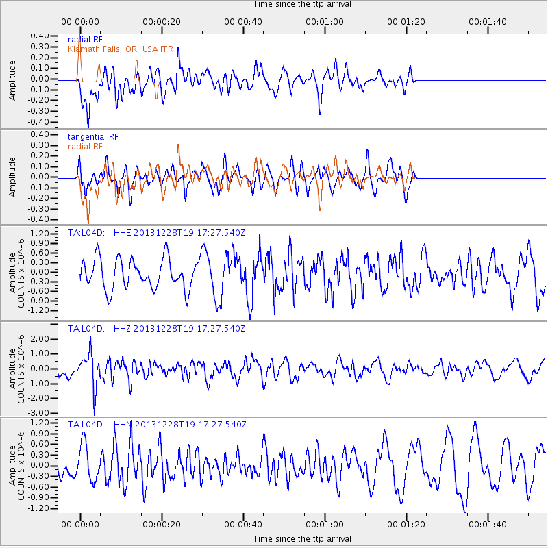
L04D Klamath Falls, OR, USA - Earthquake Result Viewer
*The percent match for this event was below the threshold and hence no stack was calculated.
| Earthquake location: |
Tonga Islands |
| Earthquake latitude/longitude: |
-18.2/-174.3 |
| Earthquake time(UTC): |
2013/12/28 (362) 19:06:16 GMT |
| Earthquake Depth: |
96 km |
| Earthquake Magnitude: |
5.9 MWW, 5.9 MWB, 5.9 MWC |
| Earthquake Catalog/Contributor: |
NEIC PDE/NEIC COMCAT |
|
| Network: |
TA USArray Transportable Network (new EarthScope stations) |
| Station: |
L04D Klamath Falls, OR, USA |
| Lat/Lon: |
42.22 N/122.30 W |
| Elevation: |
1437 m |
|
| Distance: |
76.9 deg |
| Az: |
36.952 deg |
| Baz: |
230.288 deg |
| Ray Param: |
$rayparam |
*The percent match for this event was below the threshold and hence was not used in the summary stack. |
|
| Radial Match: |
58.954662 % |
| Radial Bump: |
400 |
| Transverse Match: |
63.265877 % |
| Transverse Bump: |
400 |
| SOD ConfigId: |
626651 |
| Insert Time: |
2014-04-20 05:06:18.186 +0000 |
| GWidth: |
2.5 |
| Max Bumps: |
400 |
| Tol: |
0.001 |
|
Signal To Noise
| Channel | StoN | STA | LTA |
| TA:L04D: :HHZ:20131228T19:17:27.540Z | 2.0572355 | 1.1311286E-6 | 5.4982945E-7 |
| TA:L04D: :HHN:20131228T19:17:27.540Z | 1.232273 | 5.1204296E-7 | 4.155272E-7 |
| TA:L04D: :HHE:20131228T19:17:27.540Z | 1.7056762 | 7.6567454E-7 | 4.4889794E-7 |
| Arrivals |
| Ps | |
| PpPs | |
| PsPs/PpSs | |


