You are here: Home > Network List > US - United States National Seismic Network Stations List
> Station ELK Elko, Nevada, USA > Earthquake Result Viewer
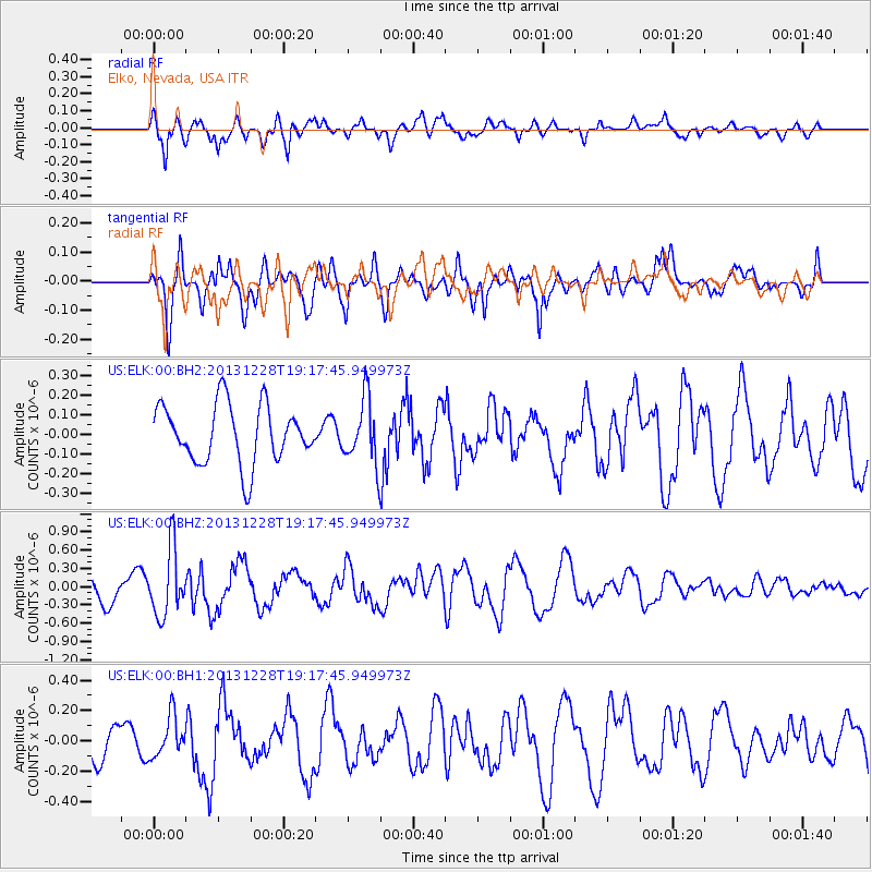
ELK Elko, Nevada, USA - Earthquake Result Viewer
*The percent match for this event was below the threshold and hence no stack was calculated.
| Earthquake location: |
Tonga Islands |
| Earthquake latitude/longitude: |
-18.2/-174.3 |
| Earthquake time(UTC): |
2013/12/28 (362) 19:06:16 GMT |
| Earthquake Depth: |
96 km |
| Earthquake Magnitude: |
5.9 MWW, 5.9 MWB, 5.9 MWC |
| Earthquake Catalog/Contributor: |
NEIC PDE/NEIC COMCAT |
|
| Network: |
US United States National Seismic Network |
| Station: |
ELK Elko, Nevada, USA |
| Lat/Lon: |
40.74 N/115.24 W |
| Elevation: |
2210 m |
|
| Distance: |
80.3 deg |
| Az: |
41.404 deg |
| Baz: |
235.837 deg |
| Ray Param: |
$rayparam |
*The percent match for this event was below the threshold and hence was not used in the summary stack. |
|
| Radial Match: |
66.64457 % |
| Radial Bump: |
400 |
| Transverse Match: |
68.51398 % |
| Transverse Bump: |
399 |
| SOD ConfigId: |
626651 |
| Insert Time: |
2014-04-20 05:07:56.258 +0000 |
| GWidth: |
2.5 |
| Max Bumps: |
400 |
| Tol: |
0.001 |
|
Signal To Noise
| Channel | StoN | STA | LTA |
| US:ELK:00:BHZ:20131228T19:17:45.949973Z | 2.2350323 | 5.4297715E-7 | 2.4293928E-7 |
| US:ELK:00:BH1:20131228T19:17:45.949973Z | 1.2125583 | 1.3542082E-7 | 1.11681906E-7 |
| US:ELK:00:BH2:20131228T19:17:45.949973Z | 1.1085202 | 1.6491593E-7 | 1.4877126E-7 |
| Arrivals |
| Ps | |
| PpPs | |
| PsPs/PpSs | |


