You are here: Home > Network List > US - United States National Seismic Network Stations List
> Station HAWA Hanford, Washington, USA > Earthquake Result Viewer
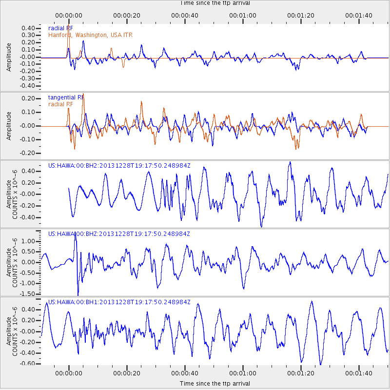
HAWA Hanford, Washington, USA - Earthquake Result Viewer
*The percent match for this event was below the threshold and hence no stack was calculated.
| Earthquake location: |
Tonga Islands |
| Earthquake latitude/longitude: |
-18.2/-174.3 |
| Earthquake time(UTC): |
2013/12/28 (362) 19:06:16 GMT |
| Earthquake Depth: |
96 km |
| Earthquake Magnitude: |
5.9 MWW, 5.9 MWB, 5.9 MWC |
| Earthquake Catalog/Contributor: |
NEIC PDE/NEIC COMCAT |
|
| Network: |
US United States National Seismic Network |
| Station: |
HAWA Hanford, Washington, USA |
| Lat/Lon: |
46.39 N/119.53 W |
| Elevation: |
364 m |
|
| Distance: |
81.1 deg |
| Az: |
34.92 deg |
| Baz: |
231.83 deg |
| Ray Param: |
$rayparam |
*The percent match for this event was below the threshold and hence was not used in the summary stack. |
|
| Radial Match: |
71.75403 % |
| Radial Bump: |
400 |
| Transverse Match: |
52.20954 % |
| Transverse Bump: |
383 |
| SOD ConfigId: |
626651 |
| Insert Time: |
2014-04-20 05:07:59.610 +0000 |
| GWidth: |
2.5 |
| Max Bumps: |
400 |
| Tol: |
0.001 |
|
Signal To Noise
| Channel | StoN | STA | LTA |
| US:HAWA:00:BHZ:20131228T19:17:50.248984Z | 3.250307 | 6.911172E-7 | 2.1263135E-7 |
| US:HAWA:00:BH1:20131228T19:17:50.248984Z | 0.8194026 | 2.1409414E-7 | 2.6128077E-7 |
| US:HAWA:00:BH2:20131228T19:17:50.248984Z | 1.1096163 | 1.7501063E-7 | 1.5772174E-7 |
| Arrivals |
| Ps | |
| PpPs | |
| PsPs/PpSs | |


