You are here: Home > Network List > UW - Pacific Northwest Regional Seismic Network Stations List
> Station LTY Liberty (broad-band) > Earthquake Result Viewer
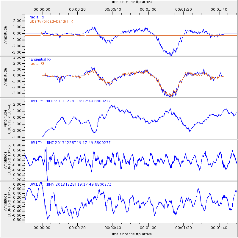
LTY Liberty (broad-band) - Earthquake Result Viewer
*The percent match for this event was below the threshold and hence no stack was calculated.
| Earthquake location: |
Tonga Islands |
| Earthquake latitude/longitude: |
-18.2/-174.3 |
| Earthquake time(UTC): |
2013/12/28 (362) 19:06:16 GMT |
| Earthquake Depth: |
96 km |
| Earthquake Magnitude: |
5.9 MWW, 5.9 MWB, 5.9 MWC |
| Earthquake Catalog/Contributor: |
NEIC PDE/NEIC COMCAT |
|
| Network: |
UW Pacific Northwest Regional Seismic Network |
| Station: |
LTY Liberty (broad-band) |
| Lat/Lon: |
47.26 N/120.66 W |
| Elevation: |
970 m |
|
| Distance: |
81.0 deg |
| Az: |
33.746 deg |
| Baz: |
230.824 deg |
| Ray Param: |
$rayparam |
*The percent match for this event was below the threshold and hence was not used in the summary stack. |
|
| Radial Match: |
45.609905 % |
| Radial Bump: |
400 |
| Transverse Match: |
44.68473 % |
| Transverse Bump: |
400 |
| SOD ConfigId: |
626651 |
| Insert Time: |
2014-04-20 05:10:08.887 +0000 |
| GWidth: |
2.5 |
| Max Bumps: |
400 |
| Tol: |
0.001 |
|
Signal To Noise
| Channel | StoN | STA | LTA |
| UW:LTY: :BHZ:20131228T19:17:49.880027Z | 2.4125915 | 4.709856E-7 | 1.9521978E-7 |
| UW:LTY: :BHN:20131228T19:17:49.880027Z | 2.4861083 | 6.7882326E-7 | 2.730465E-7 |
| UW:LTY: :BHE:20131228T19:17:49.880027Z | 1.3928068 | 1.0995045E-6 | 7.894164E-7 |
| Arrivals |
| Ps | |
| PpPs | |
| PsPs/PpSs | |


