You are here: Home > Network List > UW - Pacific Northwest Regional Seismic Network Stations List
> Station OMAK Colville Reservation, Omak, WA, USA > Earthquake Result Viewer
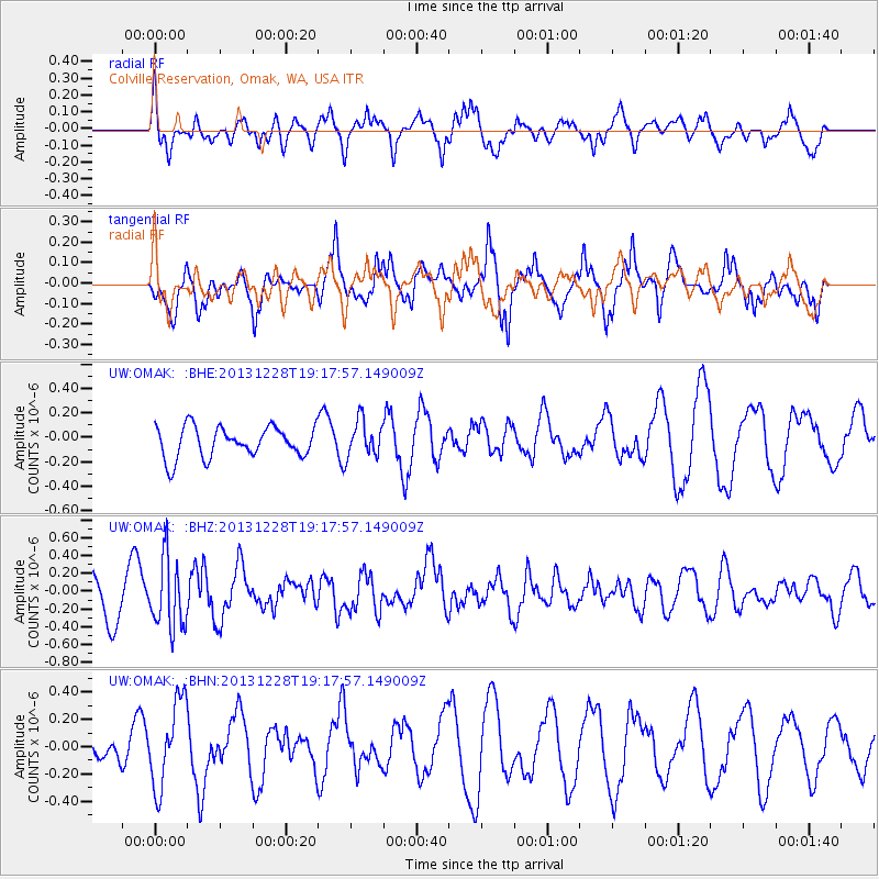
OMAK Colville Reservation, Omak, WA, USA - Earthquake Result Viewer
*The percent match for this event was below the threshold and hence no stack was calculated.
| Earthquake location: |
Tonga Islands |
| Earthquake latitude/longitude: |
-18.2/-174.3 |
| Earthquake time(UTC): |
2013/12/28 (362) 19:06:16 GMT |
| Earthquake Depth: |
96 km |
| Earthquake Magnitude: |
5.9 MWW, 5.9 MWB, 5.9 MWC |
| Earthquake Catalog/Contributor: |
NEIC PDE/NEIC COMCAT |
|
| Network: |
UW Pacific Northwest Regional Seismic Network |
| Station: |
OMAK Colville Reservation, Omak, WA, USA |
| Lat/Lon: |
48.36 N/119.33 W |
| Elevation: |
696 m |
|
| Distance: |
82.4 deg |
| Az: |
33.443 deg |
| Baz: |
231.764 deg |
| Ray Param: |
$rayparam |
*The percent match for this event was below the threshold and hence was not used in the summary stack. |
|
| Radial Match: |
55.28165 % |
| Radial Bump: |
400 |
| Transverse Match: |
72.51469 % |
| Transverse Bump: |
395 |
| SOD ConfigId: |
626651 |
| Insert Time: |
2014-04-20 05:10:09.771 +0000 |
| GWidth: |
2.5 |
| Max Bumps: |
400 |
| Tol: |
0.001 |
|
Signal To Noise
| Channel | StoN | STA | LTA |
| UW:OMAK: :BHZ:20131228T19:17:57.149009Z | 1.8151566 | 3.8431105E-7 | 2.1172336E-7 |
| UW:OMAK: :BHN:20131228T19:17:57.149009Z | 2.8453434 | 3.1210104E-7 | 1.0968836E-7 |
| UW:OMAK: :BHE:20131228T19:17:57.149009Z | 1.186179 | 1.476913E-7 | 1.2451011E-7 |
| Arrivals |
| Ps | |
| PpPs | |
| PsPs/PpSs | |


