You are here: Home > Network List > G - GEOSCOPE Stations List
> Station TAOE Taiohae, Marquises islands > Earthquake Result Viewer
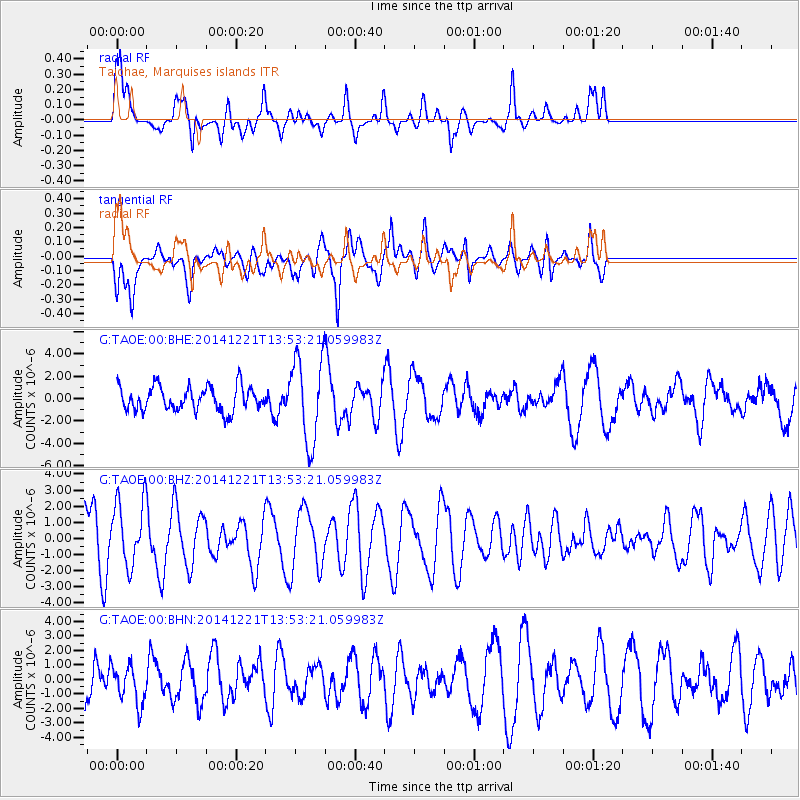
TAOE Taiohae, Marquises islands - Earthquake Result Viewer
*The percent match for this event was below the threshold and hence no stack was calculated.
| Earthquake location: |
Northern Molucca Sea |
| Earthquake latitude/longitude: |
2.1/126.6 |
| Earthquake time(UTC): |
2014/12/21 (355) 13:40:41 GMT |
| Earthquake Depth: |
48 km |
| Earthquake Magnitude: |
5.5 MW, 5.2 mb |
| Earthquake Catalog/Contributor: |
ISC/ISC |
|
| Network: |
G GEOSCOPE |
| Station: |
TAOE Taiohae, Marquises islands |
| Lat/Lon: |
8.85 S/140.15 W |
| Elevation: |
800 m |
|
| Distance: |
93.5 deg |
| Az: |
98.691 deg |
| Baz: |
271.52 deg |
| Ray Param: |
$rayparam |
*The percent match for this event was below the threshold and hence was not used in the summary stack. |
|
| Radial Match: |
52.02561 % |
| Radial Bump: |
371 |
| Transverse Match: |
65.88548 % |
| Transverse Bump: |
400 |
| SOD ConfigId: |
3390531 |
| Insert Time: |
2019-04-15 17:36:49.591 +0000 |
| GWidth: |
2.5 |
| Max Bumps: |
400 |
| Tol: |
0.001 |
|
Signal To Noise
| Channel | StoN | STA | LTA |
| G:TAOE:00:BHZ:20141221T13:53:21.059983Z | 1.4879445 | 2.0205566E-6 | 1.3579516E-6 |
| G:TAOE:00:BHN:20141221T13:53:21.059983Z | 0.66280997 | 1.3236472E-6 | 1.9970237E-6 |
| G:TAOE:00:BHE:20141221T13:53:21.059983Z | 3.4393258 | 3.7317393E-6 | 1.0850206E-6 |
| Arrivals |
| Ps | |
| PpPs | |
| PsPs/PpSs | |


