You are here: Home > Network List > AZ - ANZA Regional Network Stations List
> Station SMER AZ.SMER > Earthquake Result Viewer
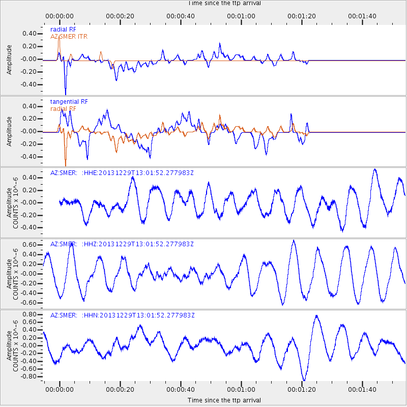
SMER AZ.SMER - Earthquake Result Viewer
*The percent match for this event was below the threshold and hence no stack was calculated.
| Earthquake location: |
New Ireland Region, P.N.G. |
| Earthquake latitude/longitude: |
-5.6/154.0 |
| Earthquake time(UTC): |
2013/12/29 (363) 12:49:16 GMT |
| Earthquake Depth: |
24 km |
| Earthquake Magnitude: |
5.5 MWW, 5.5 MWB, 5.6 MWC |
| Earthquake Catalog/Contributor: |
NEIC PDE/NEIC COMCAT |
|
| Network: |
AZ ANZA Regional Network |
| Station: |
SMER AZ.SMER |
| Lat/Lon: |
33.46 N/117.17 W |
| Elevation: |
355 m |
|
| Distance: |
92.1 deg |
| Az: |
56.759 deg |
| Baz: |
264.71 deg |
| Ray Param: |
$rayparam |
*The percent match for this event was below the threshold and hence was not used in the summary stack. |
|
| Radial Match: |
71.25504 % |
| Radial Bump: |
400 |
| Transverse Match: |
54.06861 % |
| Transverse Bump: |
400 |
| SOD ConfigId: |
626651 |
| Insert Time: |
2014-04-20 05:29:19.577 +0000 |
| GWidth: |
2.5 |
| Max Bumps: |
400 |
| Tol: |
0.001 |
|
Signal To Noise
| Channel | StoN | STA | LTA |
| AZ:SMER: :HHZ:20131229T13:01:52.277983Z | 2.0207236 | 4.228472E-7 | 2.0925535E-7 |
| AZ:SMER: :HHN:20131229T13:01:52.277983Z | 0.4589756 | 1.5559971E-7 | 3.390152E-7 |
| AZ:SMER: :HHE:20131229T13:01:52.277983Z | 1.5036424 | 2.1704452E-7 | 1.4434582E-7 |
| Arrivals |
| Ps | |
| PpPs | |
| PsPs/PpSs | |


