You are here: Home > Network List > TJ - Tajikistan National Seismic Network Stations List
> Station GARM Garm, Tajikistan > Earthquake Result Viewer
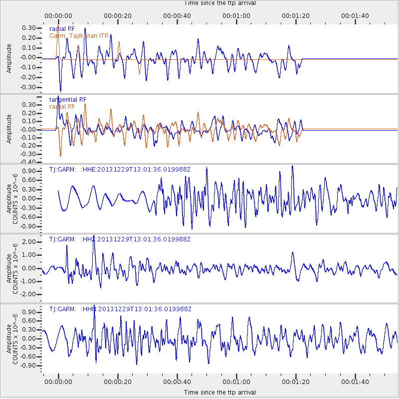
GARM Garm, Tajikistan - Earthquake Result Viewer
*The percent match for this event was below the threshold and hence no stack was calculated.
| Earthquake location: |
New Ireland Region, P.N.G. |
| Earthquake latitude/longitude: |
-5.6/154.0 |
| Earthquake time(UTC): |
2013/12/29 (363) 12:49:16 GMT |
| Earthquake Depth: |
24 km |
| Earthquake Magnitude: |
5.5 MWW, 5.5 MWB, 5.6 MWC |
| Earthquake Catalog/Contributor: |
NEIC PDE/NEIC COMCAT |
|
| Network: |
TJ Tajikistan National Seismic Network |
| Station: |
GARM Garm, Tajikistan |
| Lat/Lon: |
39.00 N/70.32 E |
| Elevation: |
1305 m |
|
| Distance: |
88.6 deg |
| Az: |
309.223 deg |
| Baz: |
98.304 deg |
| Ray Param: |
$rayparam |
*The percent match for this event was below the threshold and hence was not used in the summary stack. |
|
| Radial Match: |
61.25089 % |
| Radial Bump: |
400 |
| Transverse Match: |
52.083454 % |
| Transverse Bump: |
400 |
| SOD ConfigId: |
626651 |
| Insert Time: |
2014-04-20 05:37:15.155 +0000 |
| GWidth: |
2.5 |
| Max Bumps: |
400 |
| Tol: |
0.001 |
|
Signal To Noise
| Channel | StoN | STA | LTA |
| TJ:GARM: :HHZ:20131229T13:01:36.019988Z | 1.850042 | 5.7299485E-7 | 3.0971992E-7 |
| TJ:GARM: :HHN:20131229T13:01:36.019988Z | 1.2370844 | 3.2356763E-7 | 2.6155664E-7 |
| TJ:GARM: :HHE:20131229T13:01:36.019988Z | 1.470645 | 3.1141005E-7 | 2.1175066E-7 |
| Arrivals |
| Ps | |
| PpPs | |
| PsPs/PpSs | |


