You are here: Home > Network List > UW - Pacific Northwest Regional Seismic Network Stations List
> Station MRBL Marblemount, WA, USA > Earthquake Result Viewer
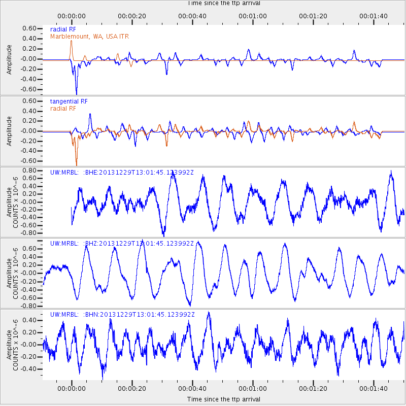
MRBL Marblemount, WA, USA - Earthquake Result Viewer
*The percent match for this event was below the threshold and hence no stack was calculated.
| Earthquake location: |
New Ireland Region, P.N.G. |
| Earthquake latitude/longitude: |
-5.6/154.0 |
| Earthquake time(UTC): |
2013/12/29 (363) 12:49:16 GMT |
| Earthquake Depth: |
24 km |
| Earthquake Magnitude: |
5.5 MWW, 5.5 MWB, 5.6 MWC |
| Earthquake Catalog/Contributor: |
NEIC PDE/NEIC COMCAT |
|
| Network: |
UW Pacific Northwest Regional Seismic Network |
| Station: |
MRBL Marblemount, WA, USA |
| Lat/Lon: |
48.52 N/121.48 W |
| Elevation: |
75 m |
|
| Distance: |
90.5 deg |
| Az: |
41.443 deg |
| Baz: |
262.219 deg |
| Ray Param: |
$rayparam |
*The percent match for this event was below the threshold and hence was not used in the summary stack. |
|
| Radial Match: |
60.250027 % |
| Radial Bump: |
392 |
| Transverse Match: |
68.616 % |
| Transverse Bump: |
400 |
| SOD ConfigId: |
626651 |
| Insert Time: |
2014-04-20 05:38:36.182 +0000 |
| GWidth: |
2.5 |
| Max Bumps: |
400 |
| Tol: |
0.001 |
|
Signal To Noise
| Channel | StoN | STA | LTA |
| UW:MRBL: :BHZ:20131229T13:01:45.123992Z | 1.0432197 | 3.8696365E-7 | 3.709321E-7 |
| UW:MRBL: :BHN:20131229T13:01:45.123992Z | 0.8987461 | 2.0337714E-7 | 2.2628987E-7 |
| UW:MRBL: :BHE:20131229T13:01:45.123992Z | 3.0897386 | 5.6634804E-7 | 1.8329965E-7 |
| Arrivals |
| Ps | |
| PpPs | |
| PsPs/PpSs | |


