You are here: Home > Network List > WY - Yellowstone Wyoming Seismic Network Stations List
> Station YUF Upper Falls, WY, USA > Earthquake Result Viewer
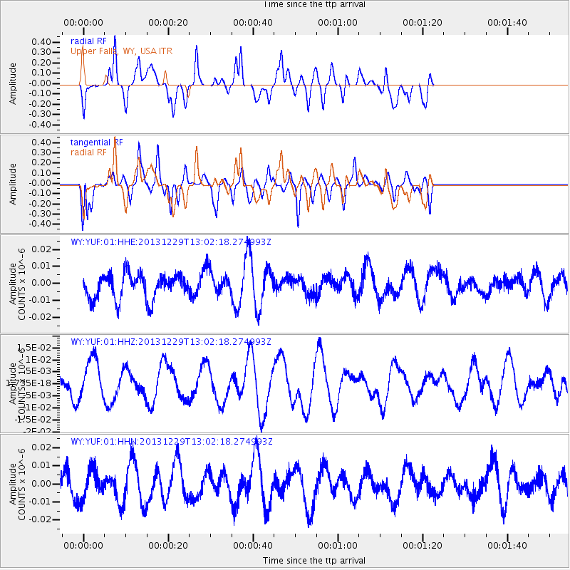
YUF Upper Falls, WY, USA - Earthquake Result Viewer
*The percent match for this event was below the threshold and hence no stack was calculated.
| Earthquake location: |
New Ireland Region, P.N.G. |
| Earthquake latitude/longitude: |
-5.6/154.0 |
| Earthquake time(UTC): |
2013/12/29 (363) 12:49:16 GMT |
| Earthquake Depth: |
24 km |
| Earthquake Magnitude: |
5.5 MWW, 5.5 MWB, 5.6 MWC |
| Earthquake Catalog/Contributor: |
NEIC PDE/NEIC COMCAT |
|
| Network: |
WY Yellowstone Wyoming Seismic Network |
| Station: |
YUF Upper Falls, WY, USA |
| Lat/Lon: |
44.71 N/110.51 W |
| Elevation: |
2394 m |
|
| Distance: |
97.8 deg |
| Az: |
45.757 deg |
| Baz: |
269.869 deg |
| Ray Param: |
$rayparam |
*The percent match for this event was below the threshold and hence was not used in the summary stack. |
|
| Radial Match: |
51.954906 % |
| Radial Bump: |
400 |
| Transverse Match: |
58.214306 % |
| Transverse Bump: |
400 |
| SOD ConfigId: |
626651 |
| Insert Time: |
2014-04-20 05:39:04.272 +0000 |
| GWidth: |
2.5 |
| Max Bumps: |
400 |
| Tol: |
0.001 |
|
Signal To Noise
| Channel | StoN | STA | LTA |
| WY:YUF:01:HHZ:20131229T13:02:18.274993Z | 1.6034067 | 8.575001E-9 | 5.347989E-9 |
| WY:YUF:01:HHN:20131229T13:02:18.274993Z | 1.752791 | 8.021788E-9 | 4.5765796E-9 |
| WY:YUF:01:HHE:20131229T13:02:18.274993Z | 0.9930618 | 7.2432607E-9 | 7.293867E-9 |
| Arrivals |
| Ps | |
| PpPs | |
| PsPs/PpSs | |


