You are here: Home > Network List > AV - Alaska Volcano Observatory Stations List
> Station SPCR Ckakachatna River, Mount Spurr, Alaska > Earthquake Result Viewer
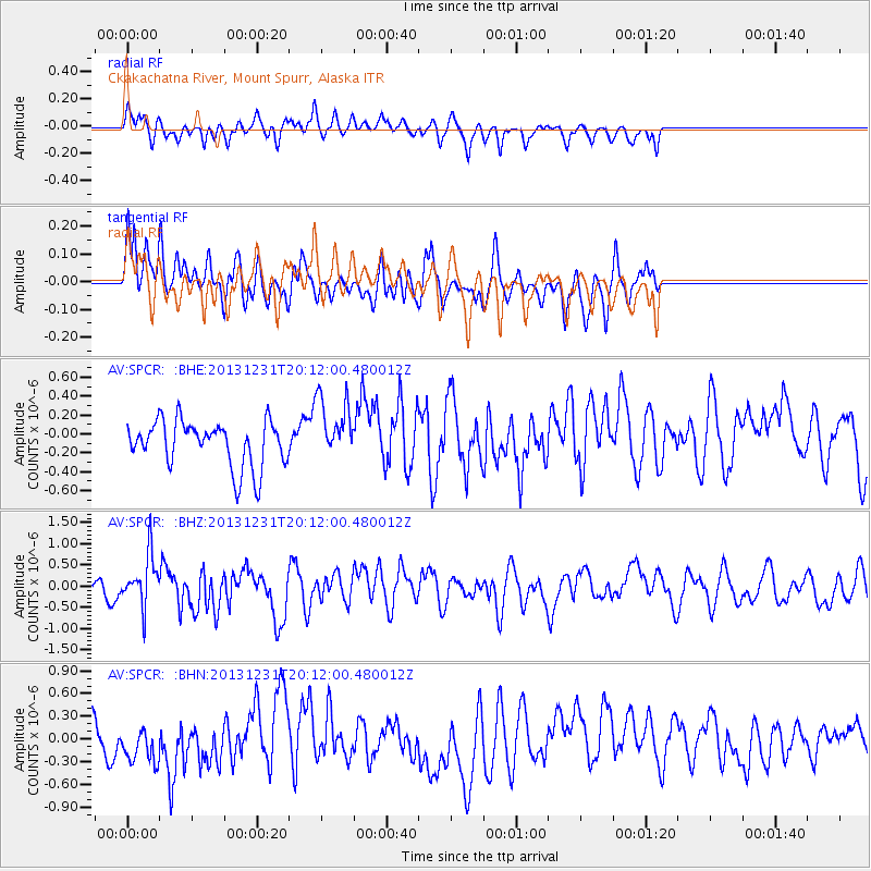
SPCR Ckakachatna River, Mount Spurr, Alaska - Earthquake Result Viewer
*The percent match for this event was below the threshold and hence no stack was calculated.
| Earthquake location: |
Philippine Islands Region |
| Earthquake latitude/longitude: |
19.1/120.3 |
| Earthquake time(UTC): |
2013/12/31 (365) 20:01:06 GMT |
| Earthquake Depth: |
11 km |
| Earthquake Magnitude: |
5.7 MWW, 5.7 MWC, 5.7 MWB |
| Earthquake Catalog/Contributor: |
NEIC PDE/NEIC COMCAT |
|
| Network: |
AV Alaska Volcano Observatory |
| Station: |
SPCR Ckakachatna River, Mount Spurr, Alaska |
| Lat/Lon: |
61.20 N/152.21 W |
| Elevation: |
984 m |
|
| Distance: |
72.3 deg |
| Az: |
30.526 deg |
| Baz: |
277.349 deg |
| Ray Param: |
$rayparam |
*The percent match for this event was below the threshold and hence was not used in the summary stack. |
|
| Radial Match: |
52.31261 % |
| Radial Bump: |
336 |
| Transverse Match: |
46.342594 % |
| Transverse Bump: |
388 |
| SOD ConfigId: |
626651 |
| Insert Time: |
2014-04-20 05:51:42.734 +0000 |
| GWidth: |
2.5 |
| Max Bumps: |
400 |
| Tol: |
0.001 |
|
Signal To Noise
| Channel | StoN | STA | LTA |
| AV:SPCR: :BHZ:20131231T20:12:00.480012Z | 2.5102417 | 5.9433523E-7 | 2.3676412E-7 |
| AV:SPCR: :BHN:20131231T20:12:00.480012Z | 0.7246338 | 2.4901505E-7 | 3.436426E-7 |
| AV:SPCR: :BHE:20131231T20:12:00.480012Z | 1.4198811 | 3.4343077E-7 | 2.418729E-7 |
| Arrivals |
| Ps | |
| PpPs | |
| PsPs/PpSs | |


