You are here: Home > Network List > TA - USArray Transportable Network (new EarthScope stations) Stations List
> Station O02D Mt. Diablo Meridian, CA, USA > Earthquake Result Viewer
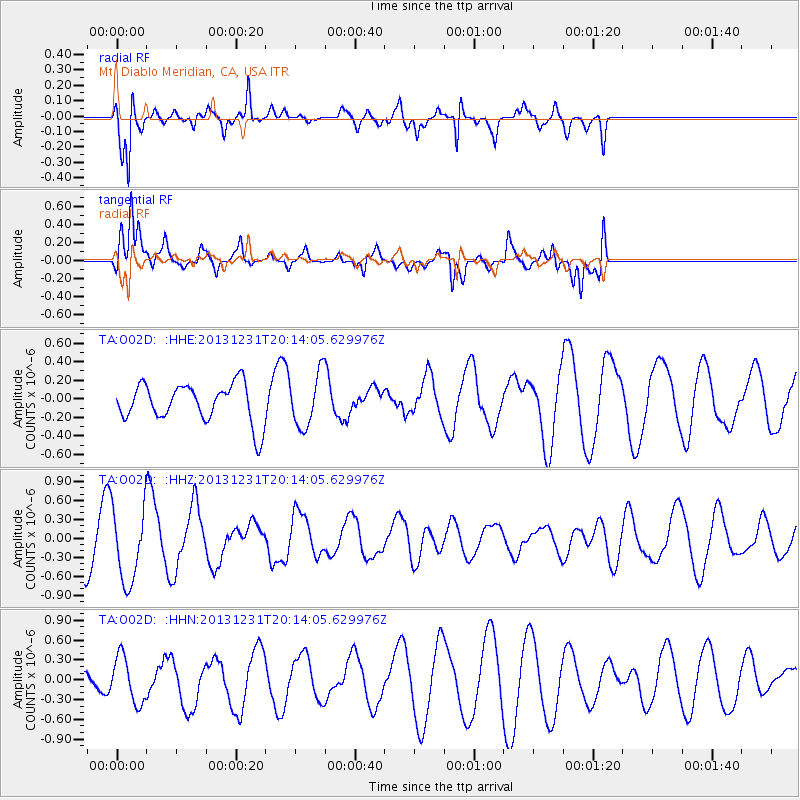
O02D Mt. Diablo Meridian, CA, USA - Earthquake Result Viewer
*The percent match for this event was below the threshold and hence no stack was calculated.
| Earthquake location: |
Philippine Islands Region |
| Earthquake latitude/longitude: |
19.1/120.3 |
| Earthquake time(UTC): |
2013/12/31 (365) 20:01:06 GMT |
| Earthquake Depth: |
11 km |
| Earthquake Magnitude: |
5.7 MWW, 5.7 MWC, 5.7 MWB |
| Earthquake Catalog/Contributor: |
NEIC PDE/NEIC COMCAT |
|
| Network: |
TA USArray Transportable Network (new EarthScope stations) |
| Station: |
O02D Mt. Diablo Meridian, CA, USA |
| Lat/Lon: |
40.18 N/122.79 W |
| Elevation: |
965 m |
|
| Distance: |
96.8 deg |
| Az: |
43.467 deg |
| Baz: |
301.902 deg |
| Ray Param: |
$rayparam |
*The percent match for this event was below the threshold and hence was not used in the summary stack. |
|
| Radial Match: |
83.978584 % |
| Radial Bump: |
400 |
| Transverse Match: |
65.13339 % |
| Transverse Bump: |
400 |
| SOD ConfigId: |
626651 |
| Insert Time: |
2014-04-20 05:59:48.907 +0000 |
| GWidth: |
2.5 |
| Max Bumps: |
400 |
| Tol: |
0.001 |
|
Signal To Noise
| Channel | StoN | STA | LTA |
| TA:O02D: :HHZ:20131231T20:14:05.629976Z | 1.902769 | 5.816515E-7 | 3.0568685E-7 |
| TA:O02D: :HHN:20131231T20:14:05.629976Z | 2.370715 | 3.5180915E-7 | 1.4839793E-7 |
| TA:O02D: :HHE:20131231T20:14:05.629976Z | 1.3688719 | 2.832556E-7 | 2.0692629E-7 |
| Arrivals |
| Ps | |
| PpPs | |
| PsPs/PpSs | |


