You are here: Home > Network List > TA - USArray Transportable Network (new EarthScope stations) Stations List
> Station H17A Grant Village (NPS), Yellowstone Nt. Park, WY, USA > Earthquake Result Viewer
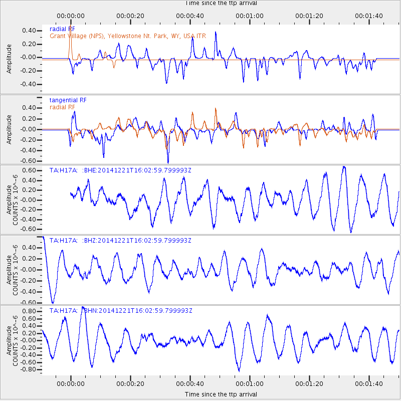
H17A Grant Village (NPS), Yellowstone Nt. Park, WY, USA - Earthquake Result Viewer
*The percent match for this event was below the threshold and hence no stack was calculated.
| Earthquake location: |
Central Italy |
| Earthquake latitude/longitude: |
43.5/12.1 |
| Earthquake time(UTC): |
2014/12/21 (355) 15:51:28 GMT |
| Earthquake Depth: |
8.3 km |
| Earthquake Magnitude: |
3.6 Mw, 3.6 ML |
| Earthquake Catalog/Contributor: |
ISC/ISC |
|
| Network: |
TA USArray Transportable Network (new EarthScope stations) |
| Station: |
H17A Grant Village (NPS), Yellowstone Nt. Park, WY, USA |
| Lat/Lon: |
44.40 N/110.58 W |
| Elevation: |
2400 m |
|
| Distance: |
78.6 deg |
| Az: |
322.033 deg |
| Baz: |
38.611 deg |
| Ray Param: |
$rayparam |
*The percent match for this event was below the threshold and hence was not used in the summary stack. |
|
| Radial Match: |
51.224216 % |
| Radial Bump: |
400 |
| Transverse Match: |
44.68777 % |
| Transverse Bump: |
400 |
| SOD ConfigId: |
3390531 |
| Insert Time: |
2019-04-15 17:52:46.122 +0000 |
| GWidth: |
2.5 |
| Max Bumps: |
400 |
| Tol: |
0.001 |
|
Signal To Noise
| Channel | StoN | STA | LTA |
| TA:H17A: :BHZ:20141221T16:02:59.799993Z | 0.23281506 | 8.027734E-8 | 3.448116E-7 |
| TA:H17A: :BHN:20141221T16:02:59.799993Z | 2.6026783 | 5.540372E-7 | 2.1287194E-7 |
| TA:H17A: :BHE:20141221T16:02:59.799993Z | 1.6775612 | 2.7371962E-7 | 1.6316523E-7 |
| Arrivals |
| Ps | |
| PpPs | |
| PsPs/PpSs | |


