You are here: Home > Network List > TA - USArray Transportable Network (new EarthScope stations) Stations List
> Station V49A McMinnville, TN, USA > Earthquake Result Viewer
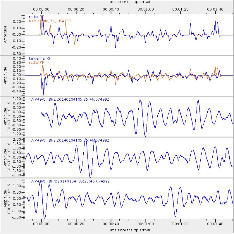
V49A McMinnville, TN, USA - Earthquake Result Viewer
*The percent match for this event was below the threshold and hence no stack was calculated.
| Earthquake location: |
Off East Coast Of Honshu, Japan |
| Earthquake latitude/longitude: |
37.0/143.4 |
| Earthquake time(UTC): |
2014/01/04 (004) 05:23:00 GMT |
| Earthquake Depth: |
22 km |
| Earthquake Magnitude: |
5.5 MWB |
| Earthquake Catalog/Contributor: |
NEIC PDE/NEIC COMCAT |
|
| Network: |
TA USArray Transportable Network (new EarthScope stations) |
| Station: |
V49A McMinnville, TN, USA |
| Lat/Lon: |
35.77 N/85.90 W |
| Elevation: |
329 m |
|
| Distance: |
94.4 deg |
| Az: |
38.187 deg |
| Baz: |
322.496 deg |
| Ray Param: |
$rayparam |
*The percent match for this event was below the threshold and hence was not used in the summary stack. |
|
| Radial Match: |
45.675083 % |
| Radial Bump: |
363 |
| Transverse Match: |
73.92518 % |
| Transverse Bump: |
400 |
| SOD ConfigId: |
626651 |
| Insert Time: |
2014-04-20 07:11:53.226 +0000 |
| GWidth: |
2.5 |
| Max Bumps: |
400 |
| Tol: |
0.001 |
|
Signal To Noise
| Channel | StoN | STA | LTA |
| TA:V49A: :BHZ:20140104T05:35:46.67499Z | 0.7702099 | 3.316031E-7 | 4.3053603E-7 |
| TA:V49A: :BHN:20140104T05:35:46.67499Z | 2.2395825 | 1.096666E-6 | 4.8967433E-7 |
| TA:V49A: :BHE:20140104T05:35:46.67499Z | 1.1533595 | 3.7183716E-7 | 3.2239487E-7 |
| Arrivals |
| Ps | |
| PpPs | |
| PsPs/PpSs | |


