You are here: Home > Network List > IU - Global Seismograph Network (GSN - IRIS/USGS) Stations List
> Station CTAO Charters Towers, Australia > Earthquake Result Viewer
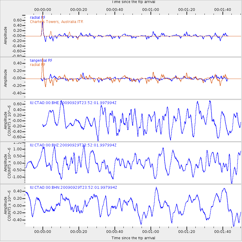
CTAO Charters Towers, Australia - Earthquake Result Viewer
*The percent match for this event was below the threshold and hence no stack was calculated.
| Earthquake location: |
Samoa Islands Region |
| Earthquake latitude/longitude: |
-15.8/-172.6 |
| Earthquake time(UTC): |
2009/09/29 (272) 23:45:03 GMT |
| Earthquake Depth: |
10 km |
| Earthquake Magnitude: |
6.0 MB, 5.8 MS |
| Earthquake Catalog/Contributor: |
WHDF/NEIC |
|
| Network: |
IU Global Seismograph Network (GSN - IRIS/USGS) |
| Station: |
CTAO Charters Towers, Australia |
| Lat/Lon: |
20.09 S/146.25 E |
| Elevation: |
357 m |
|
| Distance: |
39.3 deg |
| Az: |
257.531 deg |
| Baz: |
90.681 deg |
| Ray Param: |
$rayparam |
*The percent match for this event was below the threshold and hence was not used in the summary stack. |
|
| Radial Match: |
76.9028 % |
| Radial Bump: |
266 |
| Transverse Match: |
40.436214 % |
| Transverse Bump: |
256 |
| SOD ConfigId: |
1 |
| Insert Time: |
2010-02-19 00:23:35.414 +0000 |
| GWidth: |
2.5 |
| Max Bumps: |
400 |
| Tol: |
0.001 |
|
Signal To Noise
| Channel | StoN | STA | LTA |
| IU:CTAO:00:BHZ:20090929T23:52:01.997994Z | 2.4923952 | 8.295524E-7 | 3.328334E-7 |
| IU:CTAO:00:BHN:20090929T23:52:01.997994Z | 0.23777741 | 5.2324847E-8 | 2.2005811E-7 |
| IU:CTAO:00:BHE:20090929T23:52:01.997994Z | 1.6370767 | 4.1950952E-7 | 2.5625525E-7 |
| Arrivals |
| Ps | |
| PpPs | |
| PsPs/PpSs | |


