You are here: Home > Network List > TA - USArray Transportable Network (new EarthScope stations) Stations List
> Station T52A Hallie, KY, USA > Earthquake Result Viewer
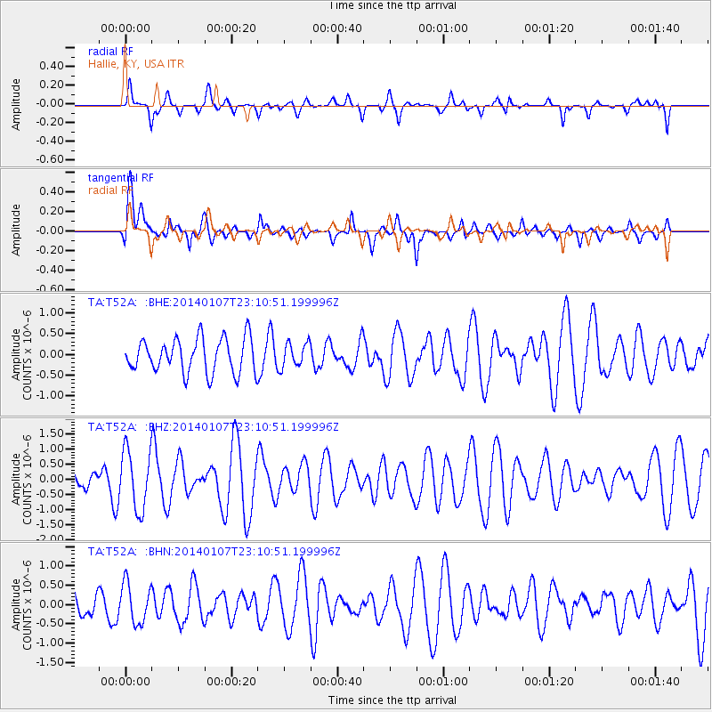
T52A Hallie, KY, USA - Earthquake Result Viewer
*The percent match for this event was below the threshold and hence no stack was calculated.
| Earthquake location: |
Central East Pacific Rise |
| Earthquake latitude/longitude: |
-4.5/-106.1 |
| Earthquake time(UTC): |
2014/01/07 (007) 23:02:53 GMT |
| Earthquake Depth: |
10 km |
| Earthquake Magnitude: |
5.7 MWB, 5.8 MWC |
| Earthquake Catalog/Contributor: |
NEIC PDE/NEIC COMCAT |
|
| Network: |
TA USArray Transportable Network (new EarthScope stations) |
| Station: |
T52A Hallie, KY, USA |
| Lat/Lon: |
37.11 N/82.99 W |
| Elevation: |
436 m |
|
| Distance: |
46.7 deg |
| Az: |
25.522 deg |
| Baz: |
212.498 deg |
| Ray Param: |
$rayparam |
*The percent match for this event was below the threshold and hence was not used in the summary stack. |
|
| Radial Match: |
65.537735 % |
| Radial Bump: |
400 |
| Transverse Match: |
55.911015 % |
| Transverse Bump: |
400 |
| SOD ConfigId: |
626651 |
| Insert Time: |
2014-04-20 08:01:18.180 +0000 |
| GWidth: |
2.5 |
| Max Bumps: |
400 |
| Tol: |
0.001 |
|
Signal To Noise
| Channel | StoN | STA | LTA |
| TA:T52A: :BHZ:20140107T23:10:51.199996Z | 2.7915394 | 9.985871E-7 | 3.5771913E-7 |
| TA:T52A: :BHN:20140107T23:10:51.199996Z | 0.98004854 | 5.223436E-7 | 5.3297725E-7 |
| TA:T52A: :BHE:20140107T23:10:51.199996Z | 0.7207463 | 2.968541E-7 | 4.1187045E-7 |
| Arrivals |
| Ps | |
| PpPs | |
| PsPs/PpSs | |


