You are here: Home > Network List > US - United States National Seismic Network Stations List
> Station HAWA Hanford, Washington, USA > Earthquake Result Viewer
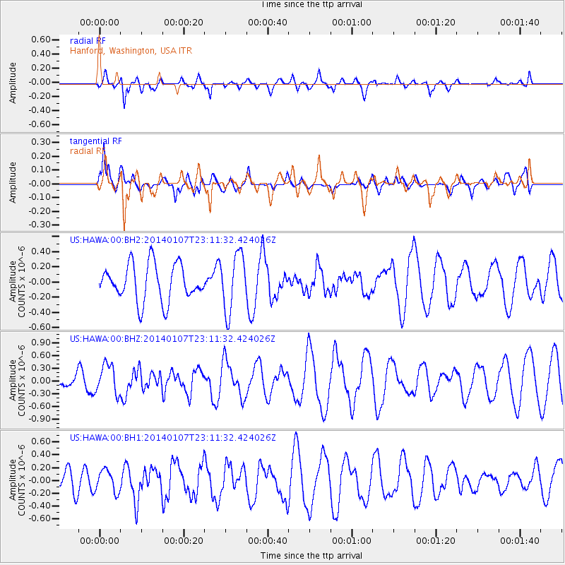
HAWA Hanford, Washington, USA - Earthquake Result Viewer
*The percent match for this event was below the threshold and hence no stack was calculated.
| Earthquake location: |
Central East Pacific Rise |
| Earthquake latitude/longitude: |
-4.5/-106.1 |
| Earthquake time(UTC): |
2014/01/07 (007) 23:02:53 GMT |
| Earthquake Depth: |
10 km |
| Earthquake Magnitude: |
5.7 MWB, 5.8 MWC |
| Earthquake Catalog/Contributor: |
NEIC PDE/NEIC COMCAT |
|
| Network: |
US United States National Seismic Network |
| Station: |
HAWA Hanford, Washington, USA |
| Lat/Lon: |
46.39 N/119.53 W |
| Elevation: |
364 m |
|
| Distance: |
52.1 deg |
| Az: |
348.217 deg |
| Baz: |
162.895 deg |
| Ray Param: |
$rayparam |
*The percent match for this event was below the threshold and hence was not used in the summary stack. |
|
| Radial Match: |
55.21243 % |
| Radial Bump: |
400 |
| Transverse Match: |
70.51892 % |
| Transverse Bump: |
400 |
| SOD ConfigId: |
626651 |
| Insert Time: |
2014-04-20 08:03:26.565 +0000 |
| GWidth: |
2.5 |
| Max Bumps: |
400 |
| Tol: |
0.001 |
|
Signal To Noise
| Channel | StoN | STA | LTA |
| US:HAWA:00:BHZ:20140107T23:11:32.424026Z | 1.4472132 | 3.490806E-7 | 2.4120885E-7 |
| US:HAWA:00:BH1:20140107T23:11:32.424026Z | 0.75114256 | 1.7144862E-7 | 2.2825044E-7 |
| US:HAWA:00:BH2:20140107T23:11:32.424026Z | 1.5851822 | 3.8248157E-7 | 2.4128556E-7 |
| Arrivals |
| Ps | |
| PpPs | |
| PsPs/PpSs | |


