You are here: Home > Network List > II - Global Seismograph Network (GSN - IRIS/IDA) Stations List
> Station WRAB Tennant Creek, NT, Australia > Earthquake Result Viewer
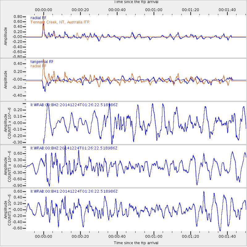
WRAB Tennant Creek, NT, Australia - Earthquake Result Viewer
*The percent match for this event was below the threshold and hence no stack was calculated.
| Earthquake location: |
West Of Macquarie Island |
| Earthquake latitude/longitude: |
-56.3/147.3 |
| Earthquake time(UTC): |
2014/12/24 (358) 01:19:38 GMT |
| Earthquake Depth: |
10 km |
| Earthquake Magnitude: |
5.5 MW, 5.2 mb, 5.2 Ms_20, 5.5 Mwb, 5.5 Mwc |
| Earthquake Catalog/Contributor: |
ISC/ISC |
|
| Network: |
II Global Seismograph Network (GSN - IRIS/IDA) |
| Station: |
WRAB Tennant Creek, NT, Australia |
| Lat/Lon: |
19.93 S/134.36 E |
| Elevation: |
366 m |
|
| Distance: |
37.6 deg |
| Az: |
339.857 deg |
| Baz: |
168.227 deg |
| Ray Param: |
$rayparam |
*The percent match for this event was below the threshold and hence was not used in the summary stack. |
|
| Radial Match: |
71.89988 % |
| Radial Bump: |
400 |
| Transverse Match: |
49.945118 % |
| Transverse Bump: |
400 |
| SOD ConfigId: |
3390531 |
| Insert Time: |
2019-04-15 18:27:09.378 +0000 |
| GWidth: |
2.5 |
| Max Bumps: |
400 |
| Tol: |
0.001 |
|
Signal To Noise
| Channel | StoN | STA | LTA |
| II:WRAB:00:BHZ:20141224T01:26:22.518986Z | 4.246491 | 4.943374E-7 | 1.164108E-7 |
| II:WRAB:00:BH1:20141224T01:26:22.518986Z | 2.4323025 | 2.0522948E-7 | 8.437663E-8 |
| II:WRAB:00:BH2:20141224T01:26:22.518986Z | 1.1098106 | 1.2087798E-7 | 1.08917675E-7 |
| Arrivals |
| Ps | |
| PpPs | |
| PsPs/PpSs | |


