You are here: Home > Network List > AZ - ANZA Regional Network Stations List
> Station SMER AZ.SMER > Earthquake Result Viewer
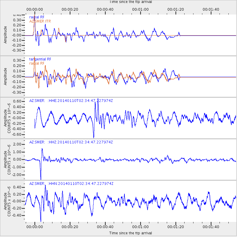
SMER AZ.SMER - Earthquake Result Viewer
*The percent match for this event was below the threshold and hence no stack was calculated.
| Earthquake location: |
Kermadec Islands Region |
| Earthquake latitude/longitude: |
-31.3/-179.6 |
| Earthquake time(UTC): |
2014/01/10 (010) 02:22:55 GMT |
| Earthquake Depth: |
211 km |
| Earthquake Magnitude: |
5.6 MWW, 5.7 MWB, 5.7 MWC |
| Earthquake Catalog/Contributor: |
NEIC PDE/NEIC COMCAT |
|
| Network: |
AZ ANZA Regional Network |
| Station: |
SMER AZ.SMER |
| Lat/Lon: |
33.46 N/117.17 W |
| Elevation: |
355 m |
|
| Distance: |
87.3 deg |
| Az: |
47.878 deg |
| Baz: |
229.408 deg |
| Ray Param: |
$rayparam |
*The percent match for this event was below the threshold and hence was not used in the summary stack. |
|
| Radial Match: |
67.65168 % |
| Radial Bump: |
319 |
| Transverse Match: |
70.14508 % |
| Transverse Bump: |
400 |
| SOD ConfigId: |
626651 |
| Insert Time: |
2014-04-20 08:47:08.408 +0000 |
| GWidth: |
2.5 |
| Max Bumps: |
400 |
| Tol: |
0.001 |
|
Signal To Noise
| Channel | StoN | STA | LTA |
| AZ:SMER: :HHZ:20140110T02:34:47.227974Z | 4.457316 | 8.03705E-7 | 1.8031143E-7 |
| AZ:SMER: :HHN:20140110T02:34:47.227974Z | 1.7723641 | 1.7371654E-7 | 9.801402E-8 |
| AZ:SMER: :HHE:20140110T02:34:47.227974Z | 1.4936856 | 2.5200563E-7 | 1.6871398E-7 |
| Arrivals |
| Ps | |
| PpPs | |
| PsPs/PpSs | |


