You are here: Home > Network List > II - Global Seismograph Network (GSN - IRIS/IDA) Stations List
> Station WRAB Tennant Creek, NT, Australia > Earthquake Result Viewer
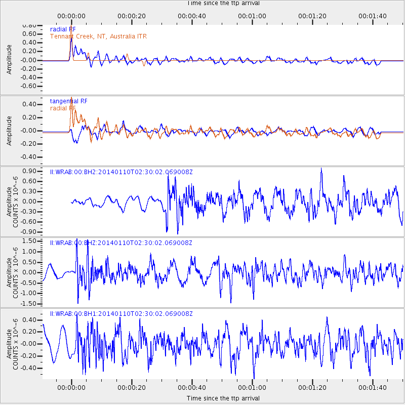
WRAB Tennant Creek, NT, Australia - Earthquake Result Viewer
*The percent match for this event was below the threshold and hence no stack was calculated.
| Earthquake location: |
Kermadec Islands Region |
| Earthquake latitude/longitude: |
-31.3/-179.6 |
| Earthquake time(UTC): |
2014/01/10 (010) 02:22:55 GMT |
| Earthquake Depth: |
211 km |
| Earthquake Magnitude: |
5.6 MWW, 5.7 MWB, 5.7 MWC |
| Earthquake Catalog/Contributor: |
NEIC PDE/NEIC COMCAT |
|
| Network: |
II Global Seismograph Network (GSN - IRIS/IDA) |
| Station: |
WRAB Tennant Creek, NT, Australia |
| Lat/Lon: |
19.93 S/134.36 E |
| Elevation: |
366 m |
|
| Distance: |
42.8 deg |
| Az: |
274.011 deg |
| Baz: |
114.839 deg |
| Ray Param: |
$rayparam |
*The percent match for this event was below the threshold and hence was not used in the summary stack. |
|
| Radial Match: |
60.664375 % |
| Radial Bump: |
400 |
| Transverse Match: |
66.98969 % |
| Transverse Bump: |
400 |
| SOD ConfigId: |
626651 |
| Insert Time: |
2014-04-20 08:50:55.293 +0000 |
| GWidth: |
2.5 |
| Max Bumps: |
400 |
| Tol: |
0.001 |
|
Signal To Noise
| Channel | StoN | STA | LTA |
| II:WRAB:00:BHZ:20140110T02:30:02.069008Z | 2.5918913 | 5.7442793E-7 | 2.2162502E-7 |
| II:WRAB:00:BH1:20140110T02:30:02.069008Z | 1.1304598 | 2.2113852E-7 | 1.9561821E-7 |
| II:WRAB:00:BH2:20140110T02:30:02.069008Z | 3.095253 | 3.8861333E-7 | 1.255514E-7 |
| Arrivals |
| Ps | |
| PpPs | |
| PsPs/PpSs | |


