You are here: Home > Network List > IU - Global Seismograph Network (GSN - IRIS/USGS) Stations List
> Station PMG Port Moresby, New Guinea > Earthquake Result Viewer
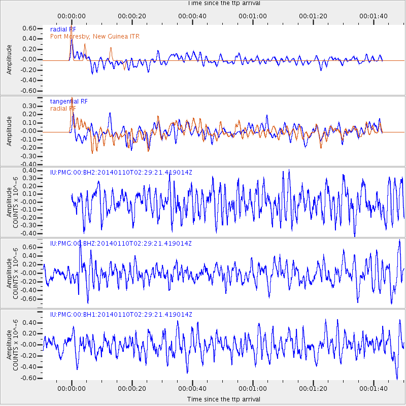
PMG Port Moresby, New Guinea - Earthquake Result Viewer
*The percent match for this event was below the threshold and hence no stack was calculated.
| Earthquake location: |
Kermadec Islands Region |
| Earthquake latitude/longitude: |
-31.3/-179.6 |
| Earthquake time(UTC): |
2014/01/10 (010) 02:22:55 GMT |
| Earthquake Depth: |
211 km |
| Earthquake Magnitude: |
5.6 MWW, 5.7 MWB, 5.7 MWC |
| Earthquake Catalog/Contributor: |
NEIC PDE/NEIC COMCAT |
|
| Network: |
IU Global Seismograph Network (GSN - IRIS/USGS) |
| Station: |
PMG Port Moresby, New Guinea |
| Lat/Lon: |
9.40 S/147.16 E |
| Elevation: |
90 m |
|
| Distance: |
37.8 deg |
| Az: |
297.994 deg |
| Baz: |
130.013 deg |
| Ray Param: |
$rayparam |
*The percent match for this event was below the threshold and hence was not used in the summary stack. |
|
| Radial Match: |
49.593445 % |
| Radial Bump: |
400 |
| Transverse Match: |
44.657288 % |
| Transverse Bump: |
400 |
| SOD ConfigId: |
626651 |
| Insert Time: |
2014-04-20 08:51:22.436 +0000 |
| GWidth: |
2.5 |
| Max Bumps: |
400 |
| Tol: |
0.001 |
|
Signal To Noise
| Channel | StoN | STA | LTA |
| IU:PMG:00:BHZ:20140110T02:29:21.419014Z | 1.7043597 | 2.6218785E-7 | 1.5383364E-7 |
| IU:PMG:00:BH1:20140110T02:29:21.419014Z | 1.4080477 | 1.932086E-7 | 1.3721737E-7 |
| IU:PMG:00:BH2:20140110T02:29:21.419014Z | 1.2069808 | 1.6035624E-7 | 1.3285732E-7 |
| Arrivals |
| Ps | |
| PpPs | |
| PsPs/PpSs | |


