You are here: Home > Network List > TA - USArray Transportable Network (new EarthScope stations) Stations List
> Station O03E Paynes Creek, CA, USA > Earthquake Result Viewer
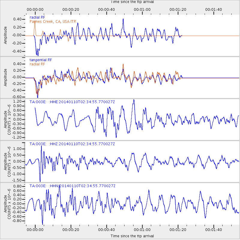
O03E Paynes Creek, CA, USA - Earthquake Result Viewer
*The percent match for this event was below the threshold and hence no stack was calculated.
| Earthquake location: |
Kermadec Islands Region |
| Earthquake latitude/longitude: |
-31.3/-179.6 |
| Earthquake time(UTC): |
2014/01/10 (010) 02:22:55 GMT |
| Earthquake Depth: |
211 km |
| Earthquake Magnitude: |
5.6 MWW, 5.7 MWB, 5.7 MWC |
| Earthquake Catalog/Contributor: |
NEIC PDE/NEIC COMCAT |
|
| Network: |
TA USArray Transportable Network (new EarthScope stations) |
| Station: |
O03E Paynes Creek, CA, USA |
| Lat/Lon: |
40.29 N/121.80 W |
| Elevation: |
967 m |
|
| Distance: |
89.1 deg |
| Az: |
40.323 deg |
| Baz: |
226.394 deg |
| Ray Param: |
$rayparam |
*The percent match for this event was below the threshold and hence was not used in the summary stack. |
|
| Radial Match: |
67.65125 % |
| Radial Bump: |
400 |
| Transverse Match: |
62.255783 % |
| Transverse Bump: |
400 |
| SOD ConfigId: |
626651 |
| Insert Time: |
2014-04-20 08:54:45.247 +0000 |
| GWidth: |
2.5 |
| Max Bumps: |
400 |
| Tol: |
0.001 |
|
Signal To Noise
| Channel | StoN | STA | LTA |
| TA:O03E: :HHZ:20140110T02:34:55.770027Z | 2.5241451 | 5.9860974E-7 | 2.3715346E-7 |
| TA:O03E: :HHN:20140110T02:34:55.770027Z | 1.5228499 | 3.10842E-7 | 2.041186E-7 |
| TA:O03E: :HHE:20140110T02:34:55.770027Z | 1.2721997 | 4.519704E-7 | 3.5526685E-7 |
| Arrivals |
| Ps | |
| PpPs | |
| PsPs/PpSs | |


