You are here: Home > Network List > NE - New England Seismic Network Stations List
> Station EMMW Machias, ME, USA > Earthquake Result Viewer
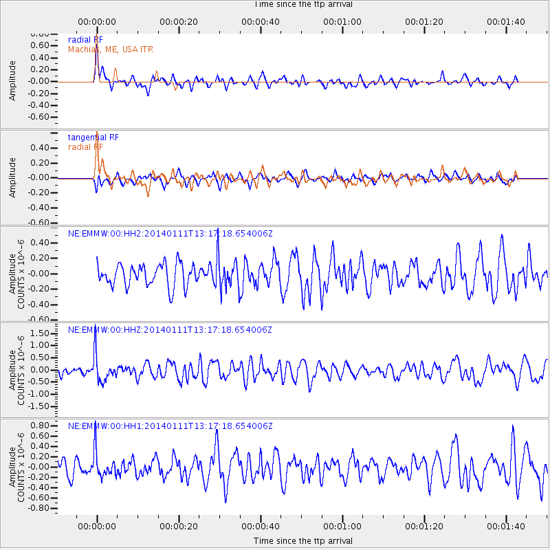
EMMW Machias, ME, USA - Earthquake Result Viewer
*The percent match for this event was below the threshold and hence no stack was calculated.
| Earthquake location: |
Near Coast Of Chiapas, Mexico |
| Earthquake latitude/longitude: |
14.6/-92.1 |
| Earthquake time(UTC): |
2014/01/11 (011) 13:10:51 GMT |
| Earthquake Depth: |
78 km |
| Earthquake Magnitude: |
5.5 MWB, 5.7 MWC |
| Earthquake Catalog/Contributor: |
NEIC PDE/NEIC COMCAT |
|
| Network: |
NE New England Seismic Network |
| Station: |
EMMW Machias, ME, USA |
| Lat/Lon: |
44.71 N/67.46 W |
| Elevation: |
35 m |
|
| Distance: |
36.5 deg |
| Az: |
29.925 deg |
| Baz: |
222.622 deg |
| Ray Param: |
$rayparam |
*The percent match for this event was below the threshold and hence was not used in the summary stack. |
|
| Radial Match: |
60.680775 % |
| Radial Bump: |
380 |
| Transverse Match: |
53.55446 % |
| Transverse Bump: |
400 |
| SOD ConfigId: |
626651 |
| Insert Time: |
2014-04-20 09:08:10.601 +0000 |
| GWidth: |
2.5 |
| Max Bumps: |
400 |
| Tol: |
0.001 |
|
Signal To Noise
| Channel | StoN | STA | LTA |
| NE:EMMW:00:HHZ:20140111T13:17:18.654006Z | 3.638538 | 5.685612E-7 | 1.562609E-7 |
| NE:EMMW:00:HH1:20140111T13:17:18.654006Z | 1.6033424 | 2.5825994E-7 | 1.6107596E-7 |
| NE:EMMW:00:HH2:20140111T13:17:18.654006Z | 1.4248682 | 2.0158402E-7 | 1.4147555E-7 |
| Arrivals |
| Ps | |
| PpPs | |
| PsPs/PpSs | |


