You are here: Home > Network List > TA - USArray Transportable Network (new EarthScope stations) Stations List
> Station G60A Masonville, QC, CAN > Earthquake Result Viewer
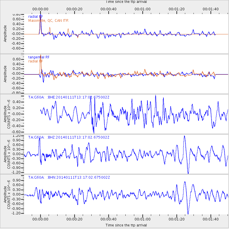
G60A Masonville, QC, CAN - Earthquake Result Viewer
*The percent match for this event was below the threshold and hence no stack was calculated.
| Earthquake location: |
Near Coast Of Chiapas, Mexico |
| Earthquake latitude/longitude: |
14.6/-92.1 |
| Earthquake time(UTC): |
2014/01/11 (011) 13:10:51 GMT |
| Earthquake Depth: |
78 km |
| Earthquake Magnitude: |
5.5 MWB, 5.7 MWC |
| Earthquake Catalog/Contributor: |
NEIC PDE/NEIC COMCAT |
|
| Network: |
TA USArray Transportable Network (new EarthScope stations) |
| Station: |
G60A Masonville, QC, CAN |
| Lat/Lon: |
45.10 N/72.33 W |
| Elevation: |
391 m |
|
| Distance: |
34.6 deg |
| Az: |
24.866 deg |
| Baz: |
215.075 deg |
| Ray Param: |
$rayparam |
*The percent match for this event was below the threshold and hence was not used in the summary stack. |
|
| Radial Match: |
66.304825 % |
| Radial Bump: |
400 |
| Transverse Match: |
47.126125 % |
| Transverse Bump: |
400 |
| SOD ConfigId: |
626651 |
| Insert Time: |
2014-04-20 09:12:41.377 +0000 |
| GWidth: |
2.5 |
| Max Bumps: |
400 |
| Tol: |
0.001 |
|
Signal To Noise
| Channel | StoN | STA | LTA |
| TA:G60A: :BHZ:20140111T13:17:02.675002Z | 3.3117962 | 4.2842646E-7 | 1.2936378E-7 |
| TA:G60A: :BHN:20140111T13:17:02.675002Z | 2.2590554 | 2.409764E-7 | 1.06671315E-7 |
| TA:G60A: :BHE:20140111T13:17:02.675002Z | 1.8865352 | 3.2392464E-7 | 1.7170348E-7 |
| Arrivals |
| Ps | |
| PpPs | |
| PsPs/PpSs | |


