You are here: Home > Network List > US - United States National Seismic Network Stations List
> Station EGMT Eagleton, Montana, USA > Earthquake Result Viewer
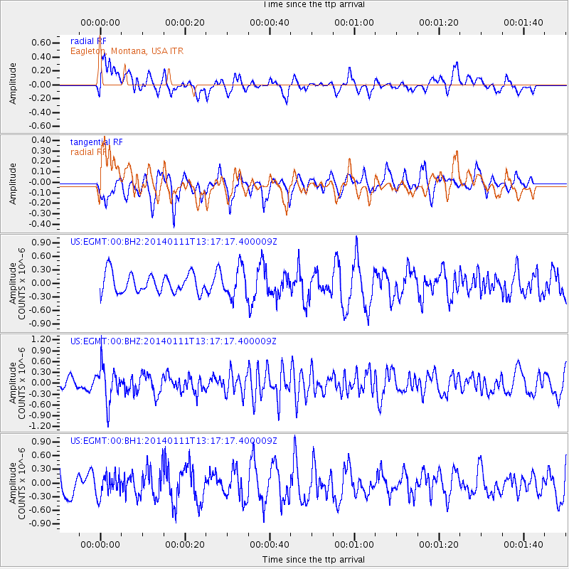
EGMT Eagleton, Montana, USA - Earthquake Result Viewer
*The percent match for this event was below the threshold and hence no stack was calculated.
| Earthquake location: |
Near Coast Of Chiapas, Mexico |
| Earthquake latitude/longitude: |
14.6/-92.1 |
| Earthquake time(UTC): |
2014/01/11 (011) 13:10:51 GMT |
| Earthquake Depth: |
78 km |
| Earthquake Magnitude: |
5.5 MWB, 5.7 MWC |
| Earthquake Catalog/Contributor: |
NEIC PDE/NEIC COMCAT |
|
| Network: |
US United States National Seismic Network |
| Station: |
EGMT Eagleton, Montana, USA |
| Lat/Lon: |
48.02 N/109.75 W |
| Elevation: |
1055 m |
|
| Distance: |
36.4 deg |
| Az: |
339.872 deg |
| Baz: |
150.253 deg |
| Ray Param: |
$rayparam |
*The percent match for this event was below the threshold and hence was not used in the summary stack. |
|
| Radial Match: |
58.325245 % |
| Radial Bump: |
400 |
| Transverse Match: |
54.523815 % |
| Transverse Bump: |
394 |
| SOD ConfigId: |
626651 |
| Insert Time: |
2014-04-20 09:16:51.457 +0000 |
| GWidth: |
2.5 |
| Max Bumps: |
400 |
| Tol: |
0.001 |
|
Signal To Noise
| Channel | StoN | STA | LTA |
| US:EGMT:00:BHZ:20140111T13:17:17.400009Z | 3.3415499 | 4.929609E-7 | 1.4752462E-7 |
| US:EGMT:00:BH1:20140111T13:17:17.400009Z | 0.841985 | 2.3497722E-7 | 2.790753E-7 |
| US:EGMT:00:BH2:20140111T13:17:17.400009Z | 1.5683439 | 3.33236E-7 | 2.1247635E-7 |
| Arrivals |
| Ps | |
| PpPs | |
| PsPs/PpSs | |


