You are here: Home > Network List > US - United States National Seismic Network Stations List
> Station ELK Elko, Nevada, USA > Earthquake Result Viewer
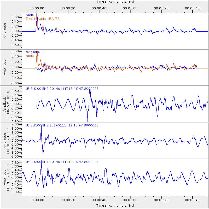
ELK Elko, Nevada, USA - Earthquake Result Viewer
*The percent match for this event was below the threshold and hence no stack was calculated.
| Earthquake location: |
Near Coast Of Chiapas, Mexico |
| Earthquake latitude/longitude: |
14.6/-92.1 |
| Earthquake time(UTC): |
2014/01/11 (011) 13:10:51 GMT |
| Earthquake Depth: |
78 km |
| Earthquake Magnitude: |
5.5 MWB, 5.7 MWC |
| Earthquake Catalog/Contributor: |
NEIC PDE/NEIC COMCAT |
|
| Network: |
US United States National Seismic Network |
| Station: |
ELK Elko, Nevada, USA |
| Lat/Lon: |
40.74 N/115.24 W |
| Elevation: |
2210 m |
|
| Distance: |
32.9 deg |
| Az: |
326.618 deg |
| Baz: |
135.496 deg |
| Ray Param: |
$rayparam |
*The percent match for this event was below the threshold and hence was not used in the summary stack. |
|
| Radial Match: |
72.722595 % |
| Radial Bump: |
400 |
| Transverse Match: |
58.530025 % |
| Transverse Bump: |
400 |
| SOD ConfigId: |
626651 |
| Insert Time: |
2014-04-20 09:16:53.265 +0000 |
| GWidth: |
2.5 |
| Max Bumps: |
400 |
| Tol: |
0.001 |
|
Signal To Noise
| Channel | StoN | STA | LTA |
| US:ELK:00:BHZ:20140111T13:16:47.800002Z | 4.497717 | 7.366373E-7 | 1.6378027E-7 |
| US:ELK:00:BH1:20140111T13:16:47.800002Z | 2.5664504 | 3.724232E-7 | 1.4511218E-7 |
| US:ELK:00:BH2:20140111T13:16:47.800002Z | 2.252314 | 3.597178E-7 | 1.5971032E-7 |
| Arrivals |
| Ps | |
| PpPs | |
| PsPs/PpSs | |


