
PAYG Puerto Ayora, Galapagos Islands - Earthquake Result Viewer
| ||||||||||||||||||
| ||||||||||||||||||
| ||||||||||||||||||
|
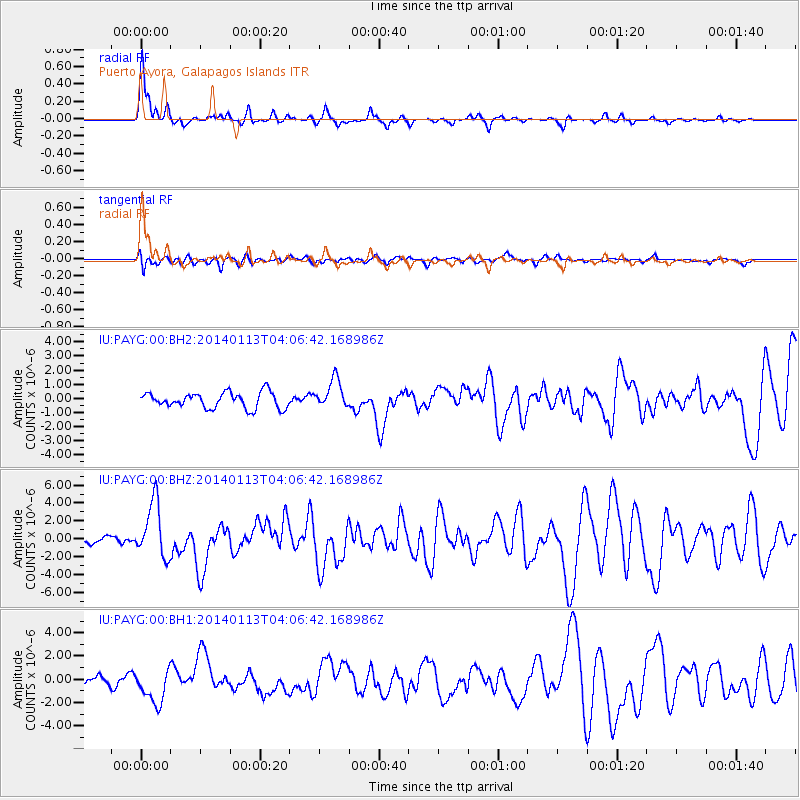
Signal To Noise
| Channel | StoN | STA | LTA |
| IU:PAYG:00:BHZ:20140113T04:06:42.168986Z | 8.021648 | 3.102565E-6 | 3.86774E-7 |
| IU:PAYG:00:BH1:20140113T04:06:42.168986Z | 4.974873 | 1.4884813E-6 | 2.9919985E-7 |
| IU:PAYG:00:BH2:20140113T04:06:42.168986Z | 1.8494536 | 1.0277221E-6 | 5.5568955E-7 |
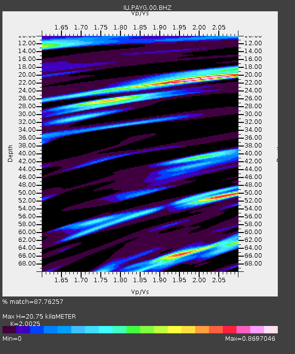
| Arrivals | |
| Ps | 4.5 SECOND |
| PpPs | 12 SECOND |
| PsPs/PpSs | 17 SECOND |

