You are here: Home > Network List > TA - USArray Transportable Network (new EarthScope stations) Stations List
> Station K49A Clarkson, MI, USA > Earthquake Result Viewer
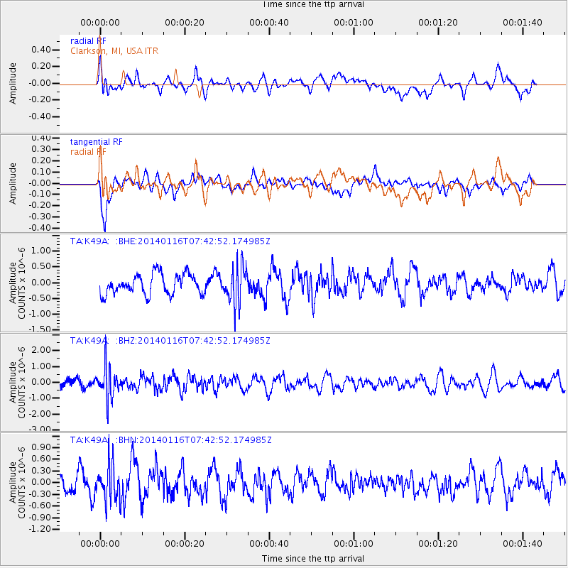
K49A Clarkson, MI, USA - Earthquake Result Viewer
*The percent match for this event was below the threshold and hence no stack was calculated.
| Earthquake location: |
Andreanof Islands, Aleutian Is. |
| Earthquake latitude/longitude: |
51.2/-179.2 |
| Earthquake time(UTC): |
2014/01/16 (016) 07:33:09 GMT |
| Earthquake Depth: |
27 km |
| Earthquake Magnitude: |
5.5 MWB, 5.2 ML, 5.5 ML, 5.6 MWC |
| Earthquake Catalog/Contributor: |
NEIC PDE/NEIC COMCAT |
|
| Network: |
TA USArray Transportable Network (new EarthScope stations) |
| Station: |
K49A Clarkson, MI, USA |
| Lat/Lon: |
42.78 N/83.46 W |
| Elevation: |
336 m |
|
| Distance: |
61.4 deg |
| Az: |
56.567 deg |
| Baz: |
314.466 deg |
| Ray Param: |
$rayparam |
*The percent match for this event was below the threshold and hence was not used in the summary stack. |
|
| Radial Match: |
53.232903 % |
| Radial Bump: |
400 |
| Transverse Match: |
61.94726 % |
| Transverse Bump: |
400 |
| SOD ConfigId: |
626651 |
| Insert Time: |
2014-04-20 10:05:56.911 +0000 |
| GWidth: |
2.5 |
| Max Bumps: |
400 |
| Tol: |
0.001 |
|
Signal To Noise
| Channel | StoN | STA | LTA |
| TA:K49A: :BHZ:20140116T07:42:52.174985Z | 2.8821893 | 9.852645E-7 | 3.4184586E-7 |
| TA:K49A: :BHN:20140116T07:42:52.174985Z | 1.615855 | 4.7805173E-7 | 2.9585064E-7 |
| TA:K49A: :BHE:20140116T07:42:52.174985Z | 1.8623526 | 5.905756E-7 | 3.1711267E-7 |
| Arrivals |
| Ps | |
| PpPs | |
| PsPs/PpSs | |


