You are here: Home > Network List > TA - USArray Transportable Network (new EarthScope stations) Stations List
> Station P48A Milroy, IN, USA > Earthquake Result Viewer
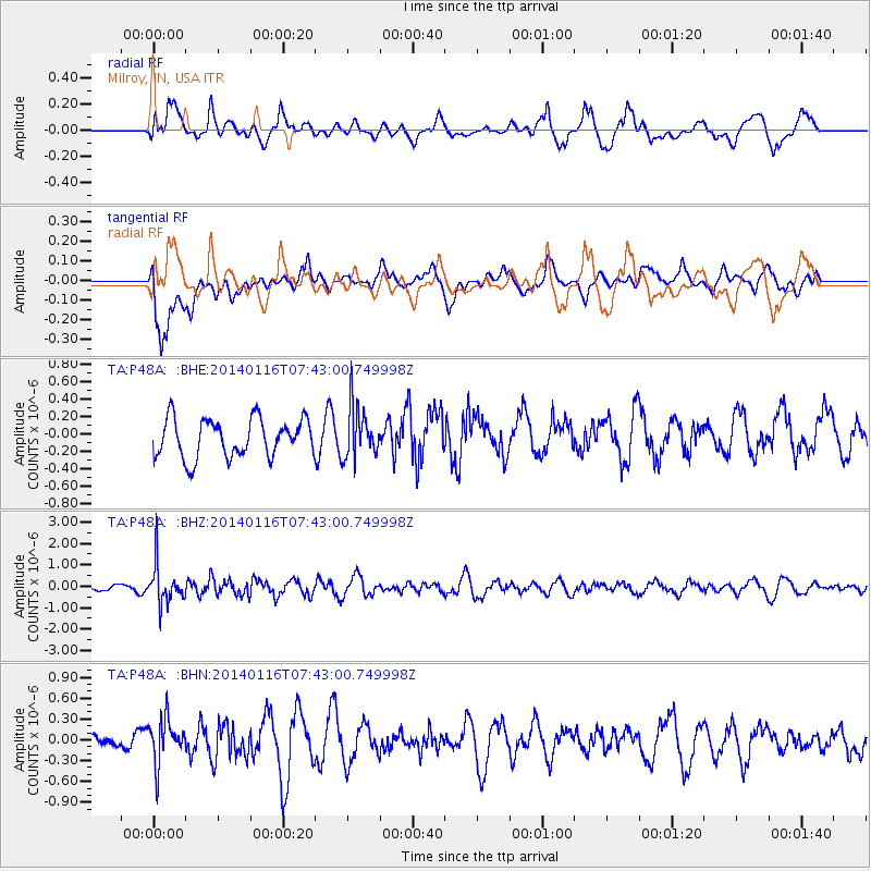
P48A Milroy, IN, USA - Earthquake Result Viewer
*The percent match for this event was below the threshold and hence no stack was calculated.
| Earthquake location: |
Andreanof Islands, Aleutian Is. |
| Earthquake latitude/longitude: |
51.2/-179.2 |
| Earthquake time(UTC): |
2014/01/16 (016) 07:33:09 GMT |
| Earthquake Depth: |
27 km |
| Earthquake Magnitude: |
5.5 MWB, 5.2 ML, 5.5 ML, 5.6 MWC |
| Earthquake Catalog/Contributor: |
NEIC PDE/NEIC COMCAT |
|
| Network: |
TA USArray Transportable Network (new EarthScope stations) |
| Station: |
P48A Milroy, IN, USA |
| Lat/Lon: |
39.46 N/85.43 W |
| Elevation: |
300 m |
|
| Distance: |
62.6 deg |
| Az: |
60.425 deg |
| Baz: |
314.986 deg |
| Ray Param: |
$rayparam |
*The percent match for this event was below the threshold and hence was not used in the summary stack. |
|
| Radial Match: |
50.649105 % |
| Radial Bump: |
400 |
| Transverse Match: |
53.790833 % |
| Transverse Bump: |
400 |
| SOD ConfigId: |
626651 |
| Insert Time: |
2014-04-20 10:08:24.225 +0000 |
| GWidth: |
2.5 |
| Max Bumps: |
400 |
| Tol: |
0.001 |
|
Signal To Noise
| Channel | StoN | STA | LTA |
| TA:P48A: :BHZ:20140116T07:43:00.749998Z | 3.691498 | 9.198654E-7 | 2.4918486E-7 |
| TA:P48A: :BHN:20140116T07:43:00.749998Z | 1.1534703 | 3.2482842E-7 | 2.816097E-7 |
| TA:P48A: :BHE:20140116T07:43:00.749998Z | 1.3640436 | 2.9639003E-7 | 2.172878E-7 |
| Arrivals |
| Ps | |
| PpPs | |
| PsPs/PpSs | |


