QSPA South Pole Remote Earth Science Observatory (Quiet Zone) - Earthquake Result Viewer
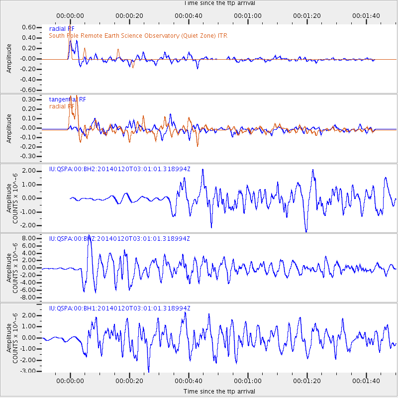
Earthquake location: North Island, New Zealand
Earthquake latitude/longitude: -40.7/175.8
Earthquake time(UTC): 2014/01/20 (020) 02:52:44 GMT
Earthquake Depth: 28 km
Earthquake Magnitude: 6.1 MWW, 6.2 MWB, 6.3 MWC
Earthquake Catalog/Contributor: NEIC PDE/NEIC COMCAT
Network: IU Global Seismograph Network (GSN - IRIS/USGS)
Station: QSPA South Pole Remote Earth Science Observatory (Quiet Zone)
Lat/Lon: 89.93 S/144.44 E
Elevation: 2850 m
Distance: 49.5 deg
Az: 180.049 deg
Baz: 31.408 deg
Ray Param: 0.06863241
Estimated Moho Depth: 25.25 km
Estimated Crust Vp/Vs: 1.60
Assumed Crust Vp: 6.193 km/s
Estimated Crust Vs: 3.871 km/s
Estimated Crust Poisson's Ratio: 0.18
Radial Match: 94.08717 %
Radial Bump: 400
Transverse Match: 87.090385 %
Transverse Bump: 400
SOD ConfigId: 626651
Insert Time: 2014-04-20 10:23:43.892 +0000
GWidth: 2.5
Max Bumps: 400
Tol: 0.001

Signal To Noise

ChannelStoNSTALTA
IU:QSPA:00:BHZ:20140120T03:01:01.318994Z9.8054332.037129E-62.0775512E-7
IU:QSPA:00:BH1:20140120T03:01:01.318994Z2.89397034.901963E-71.693854E-7
IU:QSPA:00:BH2:20140120T03:01:01.318994Z2.66755184.256811E-71.5957745E-7
Arrivals
Ps2.6 SECOND
PpPs10.0 SECOND
PsPs/PpSs13 SECOND