You are here: Home > Network List > UW - Pacific Northwest Regional Seismic Network Stations List
> Station LEBA Lebam, WA, USA > Earthquake Result Viewer
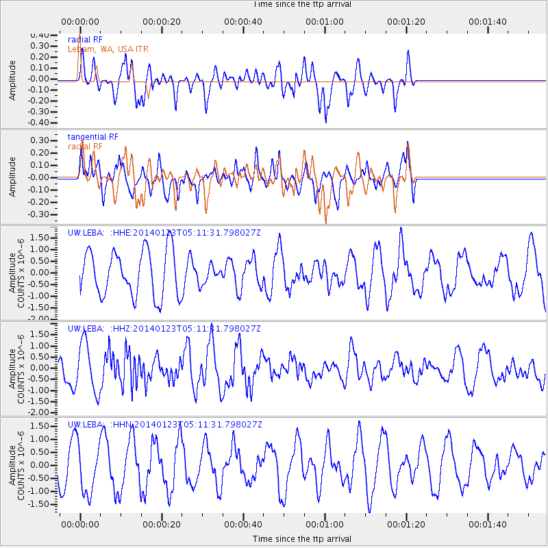
LEBA Lebam, WA, USA - Earthquake Result Viewer
*The percent match for this event was below the threshold and hence no stack was calculated.
| Earthquake location: |
South Of Mariana Islands |
| Earthquake latitude/longitude: |
13.4/146.1 |
| Earthquake time(UTC): |
2014/01/23 (023) 04:59:49 GMT |
| Earthquake Depth: |
7.0 km |
| Earthquake Magnitude: |
5.8 MWW, 5.8 MWB, 5.8 MWC |
| Earthquake Catalog/Contributor: |
NEIC PDE/NEIC COMCAT |
|
| Network: |
UW Pacific Northwest Regional Seismic Network |
| Station: |
LEBA Lebam, WA, USA |
| Lat/Lon: |
46.55 N/123.56 W |
| Elevation: |
73 m |
|
| Distance: |
80.6 deg |
| Az: |
44.387 deg |
| Baz: |
279.459 deg |
| Ray Param: |
$rayparam |
*The percent match for this event was below the threshold and hence was not used in the summary stack. |
|
| Radial Match: |
62.624836 % |
| Radial Bump: |
400 |
| Transverse Match: |
45.135662 % |
| Transverse Bump: |
344 |
| SOD ConfigId: |
626651 |
| Insert Time: |
2014-04-20 11:29:33.703 +0000 |
| GWidth: |
2.5 |
| Max Bumps: |
400 |
| Tol: |
0.001 |
|
Signal To Noise
| Channel | StoN | STA | LTA |
| UW:LEBA: :HHZ:20140123T05:11:31.798027Z | 2.9021912 | 1.1276315E-6 | 3.885449E-7 |
| UW:LEBA: :HHN:20140123T05:11:31.798027Z | 1.2705216 | 9.833313E-7 | 7.7395873E-7 |
| UW:LEBA: :HHE:20140123T05:11:31.798027Z | 0.3914586 | 3.8526133E-7 | 9.841688E-7 |
| Arrivals |
| Ps | |
| PpPs | |
| PsPs/PpSs | |


