You are here: Home > Network List > TA - USArray Transportable Network (new EarthScope stations) Stations List
> Station J01E Myrtle Point, OR, USA > Earthquake Result Viewer
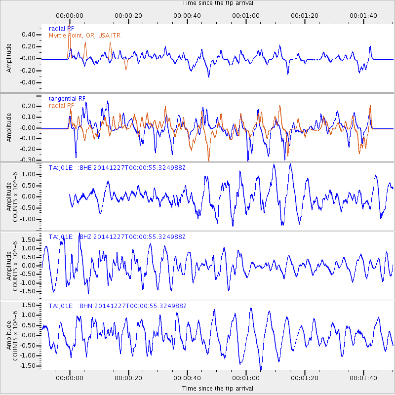
J01E Myrtle Point, OR, USA - Earthquake Result Viewer
*The percent match for this event was below the threshold and hence no stack was calculated.
| Earthquake location: |
South Of Panama |
| Earthquake latitude/longitude: |
8.0/-82.3 |
| Earthquake time(UTC): |
2014/12/26 (360) 23:52:30 GMT |
| Earthquake Depth: |
35 km |
| Earthquake Magnitude: |
6.0 MW, 6.1 ML |
| Earthquake Catalog/Contributor: |
ISC/ISC |
|
| Network: |
TA USArray Transportable Network (new EarthScope stations) |
| Station: |
J01E Myrtle Point, OR, USA |
| Lat/Lon: |
43.16 N/123.93 W |
| Elevation: |
128 m |
|
| Distance: |
50.6 deg |
| Az: |
320.978 deg |
| Baz: |
121.538 deg |
| Ray Param: |
$rayparam |
*The percent match for this event was below the threshold and hence was not used in the summary stack. |
|
| Radial Match: |
47.96427 % |
| Radial Bump: |
400 |
| Transverse Match: |
69.08878 % |
| Transverse Bump: |
400 |
| SOD ConfigId: |
3390531 |
| Insert Time: |
2019-04-15 19:37:25.169 +0000 |
| GWidth: |
2.5 |
| Max Bumps: |
400 |
| Tol: |
0.001 |
|
Signal To Noise
| Channel | StoN | STA | LTA |
| TA:J01E: :BHZ:20141227T00:00:55.324988Z | 1.5102233 | 8.3021007E-7 | 5.497267E-7 |
| TA:J01E: :BHN:20141227T00:00:55.324988Z | 0.92310363 | 6.7456057E-7 | 7.307528E-7 |
| TA:J01E: :BHE:20141227T00:00:55.324988Z | 0.8179338 | 2.1159293E-7 | 2.58692E-7 |
| Arrivals |
| Ps | |
| PpPs | |
| PsPs/PpSs | |


