You are here: Home > Network List > TA - USArray Transportable Network (new EarthScope stations) Stations List
> Station MSTX Muleshoe, TX, USA > Earthquake Result Viewer
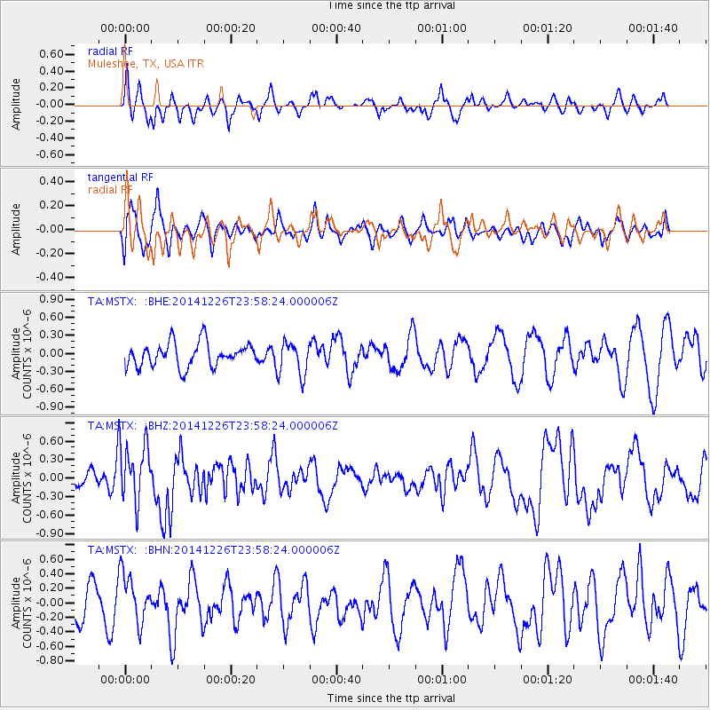
MSTX Muleshoe, TX, USA - Earthquake Result Viewer
*The percent match for this event was below the threshold and hence no stack was calculated.
| Earthquake location: |
South Of Panama |
| Earthquake latitude/longitude: |
8.0/-82.3 |
| Earthquake time(UTC): |
2014/12/26 (360) 23:52:30 GMT |
| Earthquake Depth: |
35 km |
| Earthquake Magnitude: |
6.0 MW, 6.1 ML |
| Earthquake Catalog/Contributor: |
ISC/ISC |
|
| Network: |
TA USArray Transportable Network (new EarthScope stations) |
| Station: |
MSTX Muleshoe, TX, USA |
| Lat/Lon: |
33.97 N/102.77 W |
| Elevation: |
1167 m |
|
| Distance: |
32.0 deg |
| Az: |
326.766 deg |
| Baz: |
139.217 deg |
| Ray Param: |
$rayparam |
*The percent match for this event was below the threshold and hence was not used in the summary stack. |
|
| Radial Match: |
59.289986 % |
| Radial Bump: |
400 |
| Transverse Match: |
64.191635 % |
| Transverse Bump: |
400 |
| SOD ConfigId: |
3390531 |
| Insert Time: |
2019-04-15 19:37:38.054 +0000 |
| GWidth: |
2.5 |
| Max Bumps: |
400 |
| Tol: |
0.001 |
|
Signal To Noise
| Channel | StoN | STA | LTA |
| TA:MSTX: :BHZ:20141226T23:58:24.000006Z | 3.249328 | 4.5792532E-7 | 1.4092925E-7 |
| TA:MSTX: :BHN:20141226T23:58:24.000006Z | 1.120334 | 3.2499523E-7 | 2.900878E-7 |
| TA:MSTX: :BHE:20141226T23:58:24.000006Z | 1.4070752 | 2.8207123E-7 | 2.0046636E-7 |
| Arrivals |
| Ps | |
| PpPs | |
| PsPs/PpSs | |


