You are here: Home > Network List > UW - Pacific Northwest Regional Seismic Network Stations List
> Station UMAT Pilot Rock, OR, USA > Earthquake Result Viewer
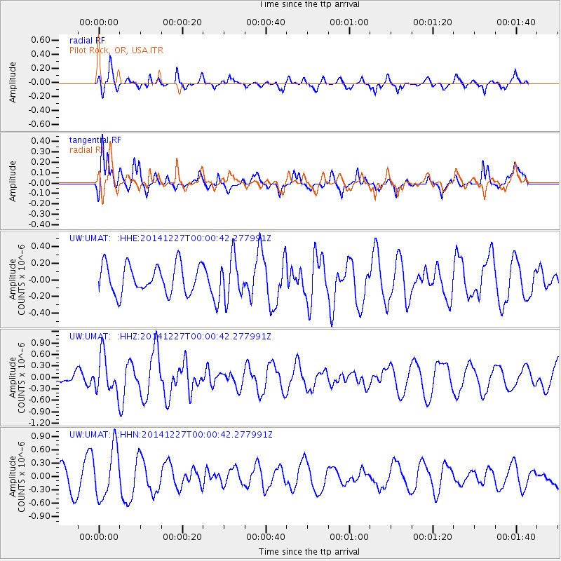
UMAT Pilot Rock, OR, USA - Earthquake Result Viewer
*The percent match for this event was below the threshold and hence no stack was calculated.
| Earthquake location: |
South Of Panama |
| Earthquake latitude/longitude: |
8.0/-82.3 |
| Earthquake time(UTC): |
2014/12/26 (360) 23:52:30 GMT |
| Earthquake Depth: |
35 km |
| Earthquake Magnitude: |
6.0 MW, 6.1 ML |
| Earthquake Catalog/Contributor: |
ISC/ISC |
|
| Network: |
UW Pacific Northwest Regional Seismic Network |
| Station: |
UMAT Pilot Rock, OR, USA |
| Lat/Lon: |
45.29 N/118.96 W |
| Elevation: |
1318 m |
|
| Distance: |
48.8 deg |
| Az: |
325.946 deg |
| Baz: |
128.211 deg |
| Ray Param: |
$rayparam |
*The percent match for this event was below the threshold and hence was not used in the summary stack. |
|
| Radial Match: |
72.4381 % |
| Radial Bump: |
380 |
| Transverse Match: |
77.48541 % |
| Transverse Bump: |
400 |
| SOD ConfigId: |
3390531 |
| Insert Time: |
2019-04-15 19:38:49.350 +0000 |
| GWidth: |
2.5 |
| Max Bumps: |
400 |
| Tol: |
0.001 |
|
Signal To Noise
| Channel | StoN | STA | LTA |
| UW:UMAT: :HHZ:20141227T00:00:42.277991Z | 2.3836842 | 5.075212E-7 | 2.1291461E-7 |
| UW:UMAT: :HHN:20141227T00:00:42.277991Z | 2.275857 | 5.695092E-7 | 2.5023945E-7 |
| UW:UMAT: :HHE:20141227T00:00:42.277991Z | 1.4266346 | 2.4309188E-7 | 1.7039535E-7 |
| Arrivals |
| Ps | |
| PpPs | |
| PsPs/PpSs | |


