You are here: Home > Network List > TA - USArray Transportable Network (new EarthScope stations) Stations List
> Station J04D Umpqua National Forest, Toketee, OR, USA > Earthquake Result Viewer
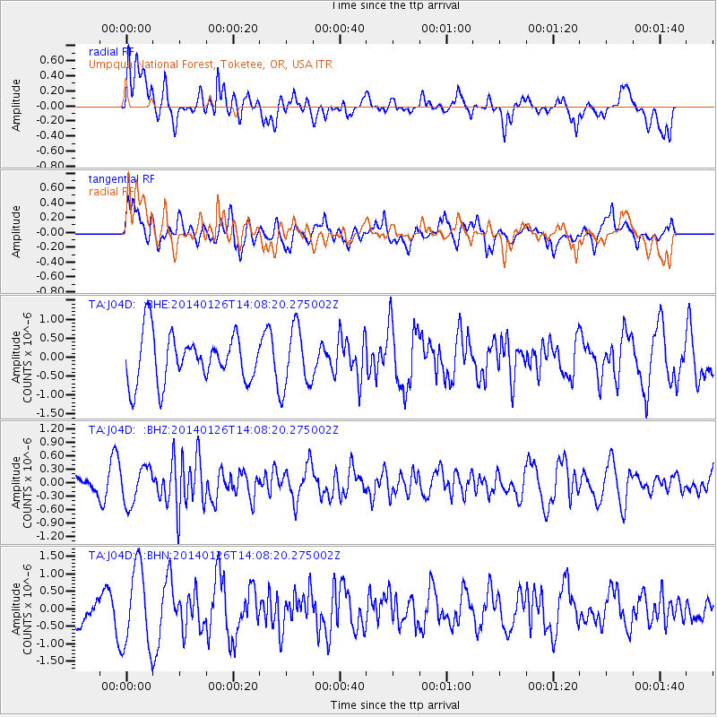
J04D Umpqua National Forest, Toketee, OR, USA - Earthquake Result Viewer
*The percent match for this event was below the threshold and hence no stack was calculated.
| Earthquake location: |
Greece |
| Earthquake latitude/longitude: |
38.2/20.5 |
| Earthquake time(UTC): |
2014/01/26 (026) 13:55:42 GMT |
| Earthquake Depth: |
8.0 km |
| Earthquake Magnitude: |
6.1 MWW, 6.1 MWB, 6.2 MWC |
| Earthquake Catalog/Contributor: |
NEIC PDE/NEIC COMCAT |
|
| Network: |
TA USArray Transportable Network (new EarthScope stations) |
| Station: |
J04D Umpqua National Forest, Toketee, OR, USA |
| Lat/Lon: |
43.24 N/122.11 W |
| Elevation: |
1948 m |
|
| Distance: |
92.1 deg |
| Az: |
333.606 deg |
| Baz: |
28.634 deg |
| Ray Param: |
$rayparam |
*The percent match for this event was below the threshold and hence was not used in the summary stack. |
|
| Radial Match: |
54.50495 % |
| Radial Bump: |
400 |
| Transverse Match: |
59.465237 % |
| Transverse Bump: |
400 |
| SOD ConfigId: |
626651 |
| Insert Time: |
2014-04-20 12:08:44.078 +0000 |
| GWidth: |
2.5 |
| Max Bumps: |
400 |
| Tol: |
0.001 |
|
Signal To Noise
| Channel | StoN | STA | LTA |
| TA:J04D: :BHZ:20140126T14:08:20.275002Z | 1.575745 | 4.1161277E-7 | 2.612179E-7 |
| TA:J04D: :BHN:20140126T14:08:20.275002Z | 1.9529749 | 1.1620085E-6 | 5.949941E-7 |
| TA:J04D: :BHE:20140126T14:08:20.275002Z | 1.2712446 | 8.0259395E-7 | 6.31345E-7 |
| Arrivals |
| Ps | |
| PpPs | |
| PsPs/PpSs | |


