You are here: Home > Network List > TA - USArray Transportable Network (new EarthScope stations) Stations List
> Station W56A Indian Trail, NC, USA > Earthquake Result Viewer
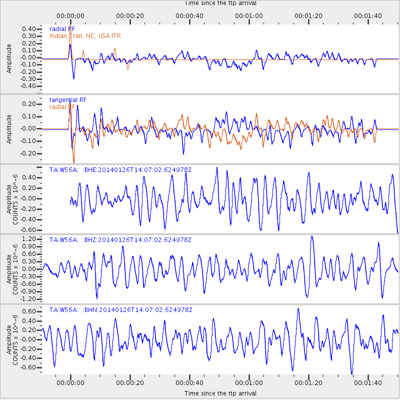
W56A Indian Trail, NC, USA - Earthquake Result Viewer
*The percent match for this event was below the threshold and hence no stack was calculated.
| Earthquake location: |
Greece |
| Earthquake latitude/longitude: |
38.2/20.5 |
| Earthquake time(UTC): |
2014/01/26 (026) 13:55:42 GMT |
| Earthquake Depth: |
8.0 km |
| Earthquake Magnitude: |
6.1 MWW, 6.1 MWB, 6.2 MWC |
| Earthquake Catalog/Contributor: |
NEIC PDE/NEIC COMCAT |
|
| Network: |
TA USArray Transportable Network (new EarthScope stations) |
| Station: |
W56A Indian Trail, NC, USA |
| Lat/Lon: |
35.13 N/80.58 W |
| Elevation: |
177 m |
|
| Distance: |
76.7 deg |
| Az: |
304.262 deg |
| Baz: |
52.597 deg |
| Ray Param: |
$rayparam |
*The percent match for this event was below the threshold and hence was not used in the summary stack. |
|
| Radial Match: |
52.589832 % |
| Radial Bump: |
400 |
| Transverse Match: |
53.036835 % |
| Transverse Bump: |
400 |
| SOD ConfigId: |
626651 |
| Insert Time: |
2014-04-20 12:12:41.889 +0000 |
| GWidth: |
2.5 |
| Max Bumps: |
400 |
| Tol: |
0.001 |
|
Signal To Noise
| Channel | StoN | STA | LTA |
| TA:W56A: :BHZ:20140126T14:07:02.624978Z | 0.98270625 | 1.96289E-7 | 1.9974331E-7 |
| TA:W56A: :BHN:20140126T14:07:02.624978Z | 1.1981562 | 2.7475286E-7 | 2.2931303E-7 |
| TA:W56A: :BHE:20140126T14:07:02.624978Z | 1.5504209 | 2.7430076E-7 | 1.7692018E-7 |
| Arrivals |
| Ps | |
| PpPs | |
| PsPs/PpSs | |


