You are here: Home > Network List > TA - USArray Transportable Network (new EarthScope stations) Stations List
> Station K48A Perry, MI, USA > Earthquake Result Viewer
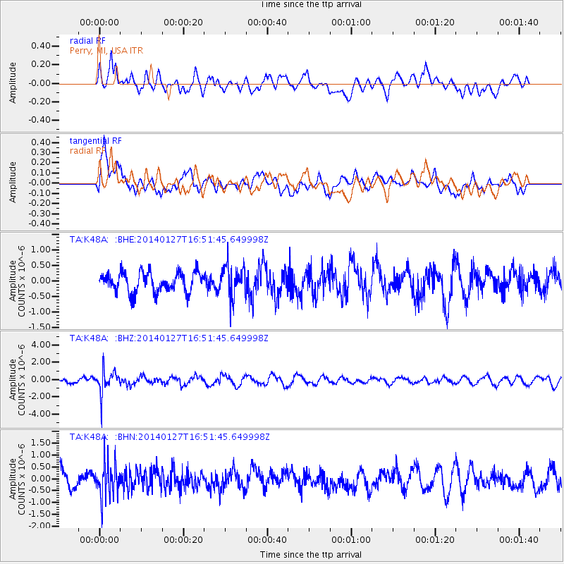
K48A Perry, MI, USA - Earthquake Result Viewer
*The percent match for this event was below the threshold and hence no stack was calculated.
| Earthquake location: |
Southern Bolivia |
| Earthquake latitude/longitude: |
-19.3/-63.9 |
| Earthquake time(UTC): |
2014/01/27 (027) 16:42:37 GMT |
| Earthquake Depth: |
600 km |
| Earthquake Magnitude: |
5.6 MWB |
| Earthquake Catalog/Contributor: |
NEIC PDE/NEIC COMCAT |
|
| Network: |
TA USArray Transportable Network (new EarthScope stations) |
| Station: |
K48A Perry, MI, USA |
| Lat/Lon: |
42.80 N/84.12 W |
| Elevation: |
273 m |
|
| Distance: |
64.5 deg |
| Az: |
343.646 deg |
| Baz: |
158.812 deg |
| Ray Param: |
$rayparam |
*The percent match for this event was below the threshold and hence was not used in the summary stack. |
|
| Radial Match: |
49.108875 % |
| Radial Bump: |
400 |
| Transverse Match: |
58.569923 % |
| Transverse Bump: |
400 |
| SOD ConfigId: |
626651 |
| Insert Time: |
2014-04-20 12:55:26.405 +0000 |
| GWidth: |
2.5 |
| Max Bumps: |
400 |
| Tol: |
0.001 |
|
Signal To Noise
| Channel | StoN | STA | LTA |
| TA:K48A: :BHZ:20140127T16:51:45.649998Z | 4.221819 | 1.3817274E-6 | 3.2728252E-7 |
| TA:K48A: :BHN:20140127T16:51:45.649998Z | 2.0280533 | 7.388223E-7 | 3.643012E-7 |
| TA:K48A: :BHE:20140127T16:51:45.649998Z | 1.6205729 | 5.157879E-7 | 3.1827506E-7 |
| Arrivals |
| Ps | |
| PpPs | |
| PsPs/PpSs | |


